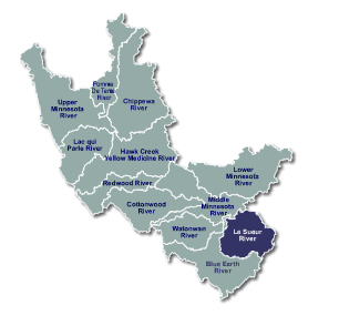
Place Names - Le Sueur River
| Le Sueur River |
 |
|
The Le Sueur River got its name from Pierre Charles Le Sueur, an early French explorer. In 1683, Le Sueur arrived at the confluence of the Minnesota and Blue Earth Rivers. Le Sueur saw the large outcrops of blue-green clay on the banks of the Blue Earth River and thought it contained copper. Le Sueur took a sample of the “ore” to Paris and received a royal commission to mine it. He returned in 1700 and set up an outpost near the confluence of the Minnesota and Blue Earth Rivers called Fort Le Huillier. The mining project was never pursued because the ore was, after all, only blue earth and had no mineral value. Fort Le Huillier was abandoned in 1702. A plaque on Highway 66 south of Mankato marks his outpost. Le Sueur’s name has been given to a Minnesota county and town as well as to a river. |
|
|
|
|
|
|
|
|
Sources Upham, Warren (1969) Minnesota Geographic Names. Minnesota Historical Society: St. Paul, MN Durand, Paul (1994) Where the Waters Gather and the Rivers Meet: An Atlas of the Eastern Sioux. Prior Lake, MN Minnesota Place Names http://mnplaces.mnhs.org/upham/ |
|
|
This page was last updated 4/15/11 |
|