Wetlands in the Minnesota River Basin
 |
View an animation. Requires the flash plug-in. Download here. |
|||
|
|
||||
 |
The landscape has been drastically altered since settlers moved in and drained the wetlands to farm the rich, productive farmland. The photo at left show farmers hand digging ditches at the turn of the century. A vast network of drainage tiles and ditches has changed the way water moves through the river Basin and the quality of that water. As a result of expanding drainage tile lines and ditches, large, previously isolated wetlands were artificially connected to the Minnesota River. Historic drain tile photos courtesy of the Minnesota Historical Society. Photo shows tiling on William Sharkey farm, Derrynane Township, LeSueur County. Photographer: William Sharkey Photograph Collection 1912-1913 Location no. HD6.3 r55 |
|||
 |
|
|||
 |
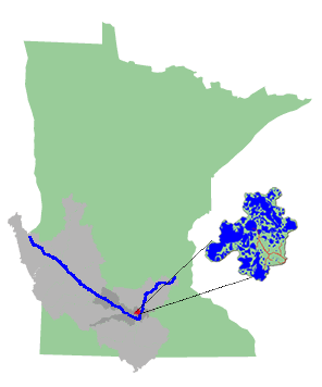
Learn more about wetlands by examining a small watershed in the Minnesota River Basin -- Seven Mile Creek Watershed (location shown on map). This watershed has dramatically transformed from the 1850s to the present. |
|||
 |
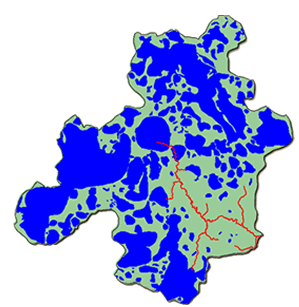
Visit the website that illustrates the changes in the extent of wetlands in Seven Mile Creek Watershed. This map shows the wetlands in the watershed in 1854 (in blue). Map courtesy of Kevin Kuehner, Brown Nicollet Cottonwood Water Quality Board |
|||
|
References: |
||||
|
This page was last updated 4/15/11
|
||||
