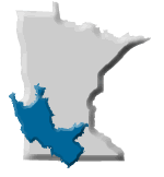
Minnesota River Basin Overview
 |
||||||
MINNESOTA RIVER VIDEOSLearn about the Minnesota River Basin by exploring over a hundred video clips of scientists, conservation leaders, citizens and other experts answering questions about the Minnesota River. Visit "Ask an Expert about the Minnesota River" VIRTUAL TOURS & STORY MAPSExplore the Minnesota River Basin by exploring the mainstem BASIN 360 Panoramic Virtual Tour WATERSHEDS Watonwan River Watershed Story Map Hawk Creek Watershed Story Map Sand Creek Watershed Story Map
|
ANIMATIONSLandscape change
Map depicting changes in the landscape, comparing 1850s and the present. Swipe map example from Watonwan River Watershed. River widening
Animation showing the change from a stable to unstable river flow. Shows channel widening, riverbank erosion and trees falling into the river. Aerial imagery from the Watonwan River Watershed. Channel straightening
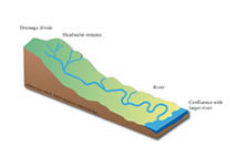
Aerial photo animation depicting channel straightening over time. Example from the Watonwan River Watershed. Watershed connections Minnesota River and Mississippi Rivers
See where the river flows from Minnesota River downstream to the Gulf of Mexico. Example from Watonwan River Watershed. |
|||||
BASIN BASICS |
|
|||||
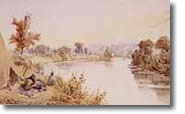
History |
|
 |
||||
Landscape & WildlifeGeology & Hydrology
|
 |
 |
||||
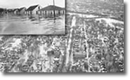
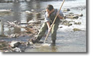
WATER QUALITY |
||||||
|
Learn more about Water Quality in the Minnesota River Basin. |
 |
|||||