Minnesota River Timeline
|
This timeline chronicles the Minnesota River from the bend in the river to celebrate Mankato's Sesquicentennial. Another basin timeline is currently in development.
|
|
| 8,000 BP Traces of first inhabitants. Native Americans live in villages near the Minnesota River thriving on hunting, fishing and cultivation of food crops. The vast prairie landscape was populated with bison, elk, wolves and grizzly bears. Dakota called the river "Minnay sotar" meaning sky-tinted water. |
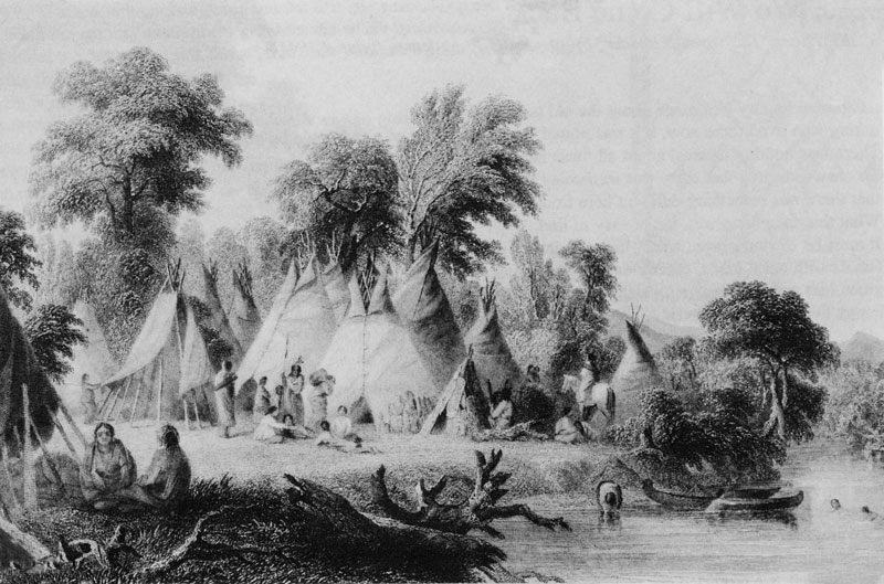 Click to enlarge |
 Click to enlarge |
For centuries, the primary rou te across the river was the shallow area near present day St. Peter. The Dakota called this place "Oiyuwege" meaning the place of crossing. French explorers called it "Traverse des Sioux" meaning the crossing place of the Sioux. |
|
1650s European explorers encounter Objibwe and Dakota inhabitants. |
|
1700 First European American settlement. Pierre Charles Le Sueur and 27 men erect a wooden fort at the junction of the Blue Earth and Le Sueur Rivers. |
|
1800-52 French and English explorers and fur traders called the river St. Peters. |
|
1803 Louisiana Purchase - Minnesota River becomes part of the United States. |
|
1835 English geologist George Featherstonhaugh makes a canoe voyage and describes the river: "Transparent waters, riverbeds of white, sand, gracefully sloping banks and abundant wildlife." At Mankato, he writes: "The loveliest encampment I had yet met with; charming slopes, with pretty dells intersecting them." |
|
1836-37 John Charles Fremont surveys the tributaries of the Minnesota River. |
|
1838 Joseph Nicolas Nicollet takes canoe journey up the river and maps the river valley. |
|
1849 Minnesota Territory formed. |
|
1851 Treaty of Traverse des Sioux - Early European American Settlement. |
|
1852 Henry Jackson and P.K. Johnson select Mankato townsite at the junction of the Blue Earth and Minnesota Rivers. |
|
1858 Minnesota Statehood. |
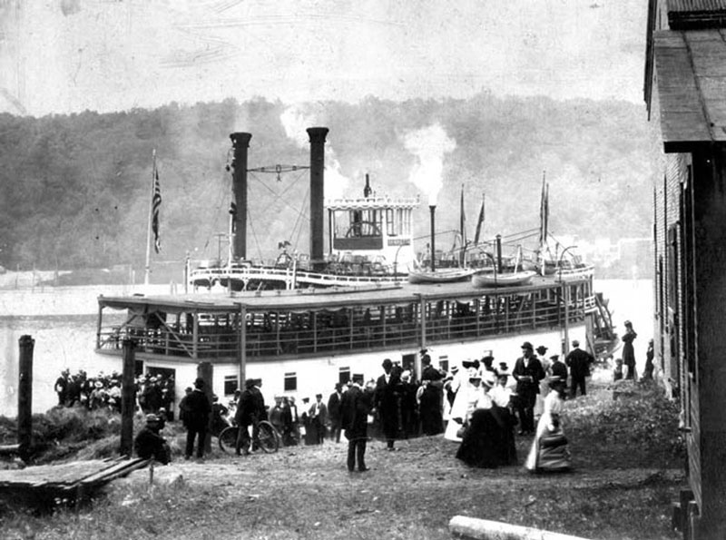
| 1860s Steamer Jeannette Roberts makes trips from St. Paul to Mankato: 40-50 staterooms onboard. |
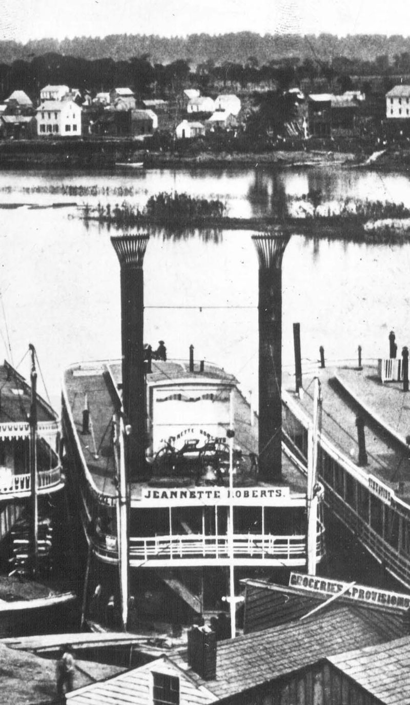 Click to enlarge |
|
1862 Tremendous flood - all bridges are destroyed and washed away. |
|
1870s Cummings Ferry docked at Sibley Park. Ten cents fare for team of horses and wagon. |
 Click to enlarge |
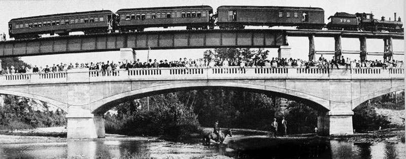
| 1879 First Iron Truss Bridge. |
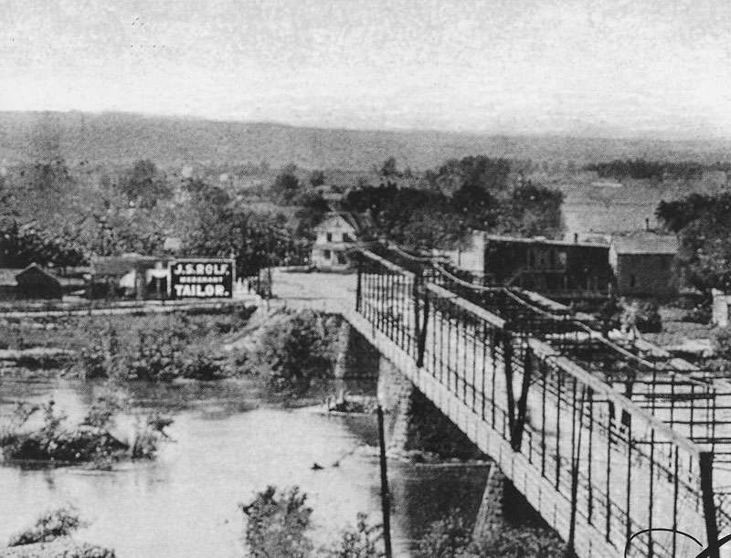 Click to enlarge |
| 1881 Largest flood on record. |
 Click to enlarge |
| 1887 Sibley Park created (junction of Blue Earth and Minnesota Rivers). |
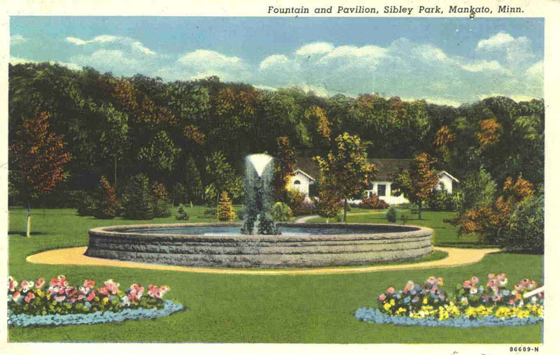 Click to enlarge |
| 1897 Last Paddle Wheeler - Henrietta. |
 Click to enlarge |
|
1899 First US pollution-control law, the Rivers and Harbors Act, forbids liquid-waste dumping, other than from sewers into navigable waters. |
| 1908 Flood (Range St.) |
 Click to enlarge |
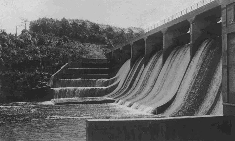
| 1910 Rapidan Dam (Blue Earth River). |
 Click to enlarge |
| 1911 Red Jacket Bridge (Le Sueur River). |
 Click to enlarge |
|
1912-23 Clamming industry booms. Shells used for cement and buttons. |
|
1917 New Concrete Bridge. |
|
1930s Damaging practices in the use of land and water are recognized as impacting water quality. |
|
1933 The US Civilian Conservation Corps workers plant trees, build dams, and pursue other environmental projects. |
|
Late 1930s In drought years, the river bottom was farmed. |
|
1945 Minnesota's Water Pollution Control Commission is established. |
|
1948 Federal Water Pollution Control Act. |
|
1950s Corps of Engineers straightened the river near Mankato (cut off meander through Hiniker Pond). |
|
1950s Post WWII growth increases demand for food. Massive agricultural drainage projects utilize more cropland and commercial fertilizers and pesticides to boost yields. |
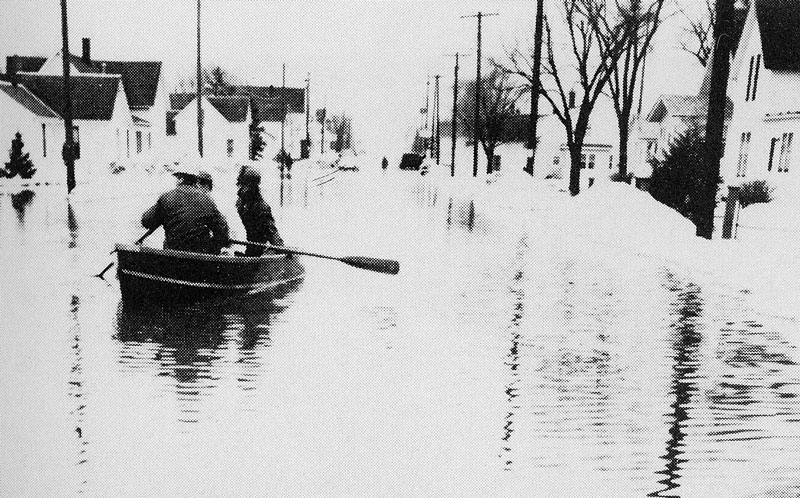
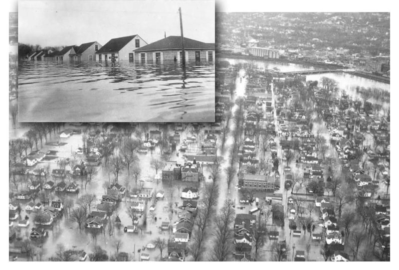
| 1951 & 1961 Major Spring Floods. More on floods. |
 Click to enlarge |
|
1959 Notable low flow year. |
|
1962 Rachel Carson writes "Silent Spring" about environmental damage caused by pesticides. |
|
1965 Flood - Major Spring Floods. More on floods. |
 Click to enlarge |
|
1967 Minnesota Pollution Control Agency replaces the Water Pollution Control Commission. |
|
1970 First Earth Day. |
|
1970 Mankato/North Mankato floodwall construction begins. Completed in 1989. |
|
1972 Federal Clean Water Act. |
|
1974 Federal Safe Drinking Water Act. |
|
1975 First Minnesota River Fish Consumption Advisory due to elevated PCBs. |
|
1976 Notable low flow year - the river was a series of separate pools connected by a small stream. |
|
1977 Minnesota Basin Report identifies problems with elevated sediment and nutrient levels and reductions in wetlands. |
|
1983 Conservation Foundation ranks Minnesota first among the 50 states in efforts to protect the environment. |
|
1985 Conservation Reserve Program established to create buffer areas of natural vegetation along rivers and streams to prevent erosion. |
| 1985 Veterans Memorial Bridge built. |
 Click to enlarge |
|
1985 River's low dissolved oxygen problem identified as a problem. |
|
1987 Water Resources Center formed at Minnesota State University, Mankato. |
|
1992 Governor Arne Carlson launches clean up program for the river which he says "needs tremendous improvement." He issued a challenge to make the river fishable and swimmable by 2002. |
|
1993 Minnesota River highest level in recorded history at Mankato. |
|
1994 Citizen Action Committee (CAC) issues plan to restore the Minnesota River. |
|
1994 Minnesota River Assessment Project (MRAP) examines the effect of pollution on the river's physical, chemical, and biological systems. |
|
1995 Minnesota River Basin Joint Powers Board formed (now called the Minnesota River Board). |
|
1997 Major flood. |
|
1997 American Rivers lists the Minnesota as one of 10 most threatened rivers in the US. |
|
1998 Conservation Reserve Enhancement Program (CREP) created to protect and enhance environmentally sensitive land in the Minnesota River Basin through volunteer enrollment in conservation easements. |
|
2000 City of Mankato constructs a $25 million wastewater treatment plant expansion to reduce impacts on the river. |
|
Photos courtesy of Blue Earth County Historical Society & the Minnesota Historical Society |