Minnesota River Basin Glaciation
 |
 |
|||
|
|
||||
|
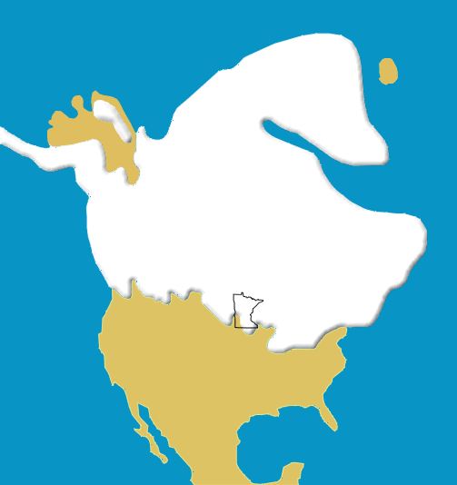
Glaciers once covered most of Minnesota. As the climate fluctuated (see graph above), great ice sheets advanced and retreated across the landscape. Glacial till, the material scraped up and carried by the ice, was deposited in distinct layers and tells the story of these paths of ice. Most of Minnesota's landscape was sculpted by glaciers. The map above illustrates the maximum extent of the ice coverage in North America during the last glacial advance (Wisconsin Glaciation). (1) |
||||
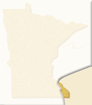 |
2,000,000 years before present (BP) Around two million years ago, the first major ice sheet advanced into the central United States about as far south as St. Louis. It covered all of Minnesota except for a small area in the Southeast corner called the "driftless" area (near present day Lanesboro). (Nebraskan Ice Stage) (2) |
|||
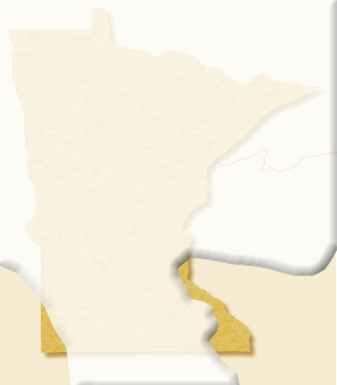 |
400,000 BP Around 400,000 years ago, another ice sheet moved across the landscape and covered most of the state. It deposited a layer of glacial till up to 50 feet thick. These deposits have a blue color due to the large amount of limestone which the glacier gathered from Manitoba and NW Minnesota. (Kansan Ice Stage) |
|||
 |
150,000 BP From roughly 150,000-120,000 years ago, another large ice sheet formed and sent lobes of ice into Minnesota in at least three advances. Much of Minnesota was likely covered. The Illinoian ice created the moraines (glacial deposits) that are the hills you can see today around Hampton and New Trier (near Redwing). (Illinoian Ice Stage) |
|||
 |
100,000 BP |
|||
 |
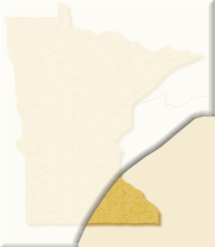
35,000 BP During the Wisconsin Ice Stage, a series of different ice lobes moved across the landscape. The lobes typically followed lowland areas. This one, called the Hawk Creek Phase, occurred approximately 35,000 years ago. These glacial deposits contain reddish materials which indicate that it was carried from the Superior basin. (Wisconsin Ice Stage) |
|||
 |
34,000 BP Approximately 34,000 years ago, lobes continued to move across the landscape. This is called the Granite Falls Phase because its deposits have been studied extensively in that area. (Wisconsin Ice Stage) |
|||
 |
30,000 BP Approximately 30,000 years ago, the Wadena lobe melted back and shaped a huge field of drumlins around Wadena, Hewitt, and Alexandria. A drumlin is a streamlined deposit of glacial till shaped like a teardrop with the tapered, narrow end pointing in the direction of glacier movement. This configuration is called the Hewitt Phase. (Wisconsin Ice Stage) |
|||
 |
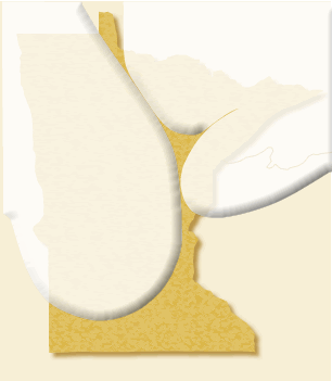
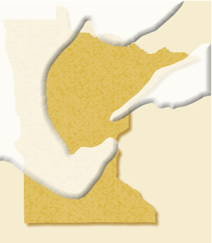
20,500 BP The Rainy and Superior lobes reached their maximum extent approximately 20,500 years ago (scroll over image for labels). This advance resulted in the St. Croix moraine which extended from Walker to St. Paul. (Wisconsin Ice Stage) |
|||
 |
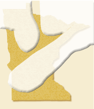
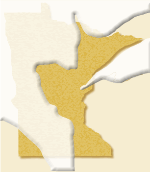
16,000 BP This configuration of the ice lobes occurred between 20,500 and 16,000 years ago. A change in climatic conditions favored the ice flowing from the west. (Wisconsin Ice Stage) |
|||
 |
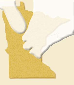
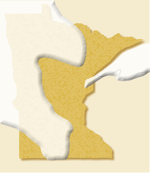
14,000 BP Approximately 14,000 years ago, during the New Ulm Phase, the ice thickened, flowed across the Mankato area and advanced southward to Des Moines Iowa. (Wisconsin Ice Stage) |
|||
 |
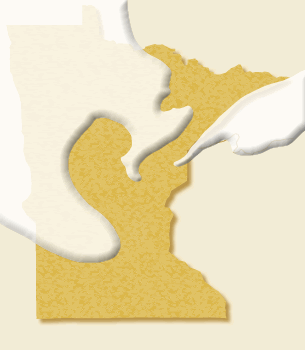
13,000 BP Approximately 13,000 years ago, during the Mankato Phase, the Des Moines lobe melted back and deposited large deposits of drift at Mankato (scroll over image for labels). (Wisconsin Ice Stage) |
|||
 |
10,500 BP The most recent advancement of glacial ice in Minnesota spanned from around 12,000 to 10,500 years ago. By this time, the ice had melted back out of Iowa and up into the lowland area of Minnesota. When these lobes melted back into the Red River Valley and the Lake Superior Basin, Glacial Lake Agassiz was formed. By 9,000 years ago, the ice sheets had melted completely from the state but the glacial lakes remained. (Wisconsin Ice Stage) |
|||
|
References:
|
||||
|
This page was last updated 4/15/11
|
||||
