UPPER MINNESOTA RIVER MAJOR WATERSHED

GEOGRAPHIC INFORMATION SYSTEM
MAPS AND DATA
ABOUT THIS SECTION
This section contains Geographical Information Systems (GIS) data and maps of the Upper Minnesota River Major Watershed. Any or all GIS data files contained in this section may be freely downloaded to your system. Each GIS data file has a corresponding map that will allow you to view the data file before downloading, a data dictionary that describes the feature attribute table, and a metadata file that will give you information on the source, quality, spatial organization, attributes, and geographic organization of the data file. The compressed file size and uncompressed file size are provided for each data file. Please contact MRBDC staff if you have questions or updated information about data contained in this section. All comments are appreciated.
HOW TO USE THIS SECTION
 Click to enlarge |
Click on small image to view a larger image. |
| Click this button to read metadata documentation. All metadata is documented in compliance with Minnesota Geographic Metadata Guidelines, a state version of the FGDC Content Standards for Geophysical Metadata. | |
| Click this button to view a complete list and brief description of polygon, line, or point feature attributes. | |
| Click this button to download the data as an ArcView SHAPE. See our download instruction page for information on downloading and using the data files. | |
| You must press the shift key as you click this button to download the data as an ARC/INFO export (.e00) file. See our download instruction page for information on downloading and using the data files. |
DISCLAIMER
These data have been developed and used by the Water Resources Center at Minnesota State University, Mankato. Although every effort has been made to validate data, no warranty, expressed or implied, is made by the Water Resources Center as to the accuracy of the data, the related maps or analysis created from such data; nor shall the fact of distribution constitute any such warranty. The Water Resources Center continues to update or correct data when necessary.
| Hydrography ( watersheds, streams, lakes, wetlands ) Civil, Political, and Public Land Survey Boundaries ( county, township, section, city ) Transportation ( Interstate, US, State, County, Township, and city roads ) Monitoring Sites ( USGS, MPCA ) Natural Resources Classification Systems ( Agroecoregions, Ecoregion, Ecosystem ) |
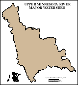
major22 [ Major Watershed ]
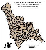
mshed22 [ Minor Watersheds ]
 Click to enlarge |
The Upper Minnesota River Major Watershed is divided into 99 minor watersheds. U.S. Geological Survey 7.5 minute series topographic maps were used as source maps on which to delineate and digitize these data. This file contains both polygon and line attributes.
|
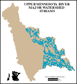
stream22 [ Streams ]
 Click to enlarge |
The Upper Minnesota River Major Watershed has over XXXX miles of streams within the state of Minnesota. U.S. Geological Survey 7.5 minute series topographic maps were used as source maps on which to digitize these data. This data file contains all streams present on these source maps for the state of Minnesota. Stream lines are not connected through lake or wetland features.
|
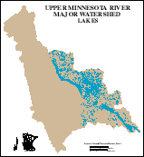
lake22 [ Lakes and other water bodies ]
 Click to enlarge |
The Upper Minnesota River Major Watershed has over XX,XXX acres of open water within the state of Minnesota. U.S. Geological Survey 7.5 minute series topographic maps were used as source maps on which to digitize these data. This data file contains all water bodies present on these source maps for the state of Minnesota.
|
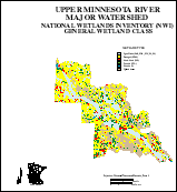
nwi22p [ National Wetlands Inventory (NWI) ]
 Click to enlarge |
The Upper Minnesota River Major Watershed contains over 78,000 acres of various wetland types within the state of Minnesota. U.S. Fish and Wildlife National Wetlands Inventory (NWI) 7.5 minute quadrangle data files were processed to produce these data. This data file contains the polygon features and attributes of NWI for the state of Minnesota.
|
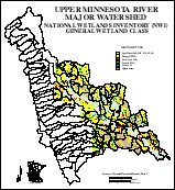
nwi22m [ National Wetlands Inventory (NWI) ]
 Click to enlarge |
This data file is similar to nwi22p (above). The minor watershed (mshed22) file is joined with the nwi22p file to facilitate ArcView users in the reselection process. This file contains the combined polygons and attributes of both files.
|
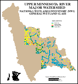
nwi22a [ National Wetlands Inventory (NWI) ]
 Click to enlarge |
U.S. Fish and Wildlife National Wetlands Inventory (NWI) 7.5 minute quadrangle data files were processed to produce these data. This data file contains only the line features and attributes of NWI. Each line contains the identity of the minor watershed in which it is located.
|
Return to top of page
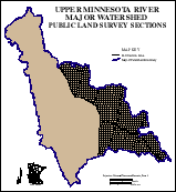
sec22 [ Minnesota Public Land Survey Sections ]
 Click to enlarge |
This data file contains Minnesota Public Land Survey sections for the Upper Minnesota River Major Watershed. U.S. Geological Survey 7.5 minute series topographic maps were used as source maps on which to digitize these data. All PLS section lines present on these source maps are included for the state of Minnesota. Section lines that are not present on the source maps (eg.. across lakes or wetland complexes) were added to complete each polygon. This data file contains both polygon and line attributes.
|
sec22m [ Minnesota Public Land Survey Sections ]
 Click to enlarge |
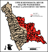
This data file is similar to sec22 (above). The minor watershed (mshed22) file is joined with the sec22 file to facilitate ArcView users in the reselection process. This data file contains the combined polygons and attributes of both files.
|
twp22 [ Minnesota Political Townships ]
 Click to enlarge |
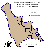
This data file contains Minnesota Public Land Survey townships for the Upper Minnesota River Major Watershed. U.S. Geological Survey 7.5 minute series topographic maps were used as source maps on which to digitize these data. All PLS township lines present on these source maps are included for the state of minnesota. Township lines that are not present on the source maps (eg.. across lakes or wetland complexes) were added to complete each polygon. This data file contains both polygon and line attributes.
|
twp22m [ Minnesota Political Townships ]
 Click to enlarge |
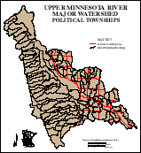
This data file is similar to twp22 (above). The minor watershed (mshed22) file is joined with the twp22 file to facilitate ArcView users in the reselection process. This data file contains the combined polygons and attributes of both files.
|
co22 [ Minnesota Political Counties ]
 Click to enlarge |
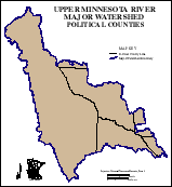
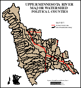
This data file contains Minnesota counties for the Upper Minnesota River Major Watershed. U.S. Geological Survey 7.5 minute series topographic maps were used as source maps on which to digitize these data. All county lines present on these source maps are included for the state of Minnesota. County lines that are not present on the source maps (eg.. across lakes or wetland complexes) were added to complete each polygon. This data file contains both polygon and line attributes.
|
co22m [ Minnesota Political County ]
 Click to enlarge |
This data file is similar to co22 (above). The minor watershed (mshed22) file is joined with the co22 file to facilitate ArcView users in the reselection process. This data file contains the combined polygons and attributes of both files.
|
muni22 [ Minnesota Municipal or Incorporated areas ]
 Click to enlarge |
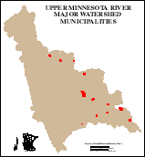
This data file contains Minnesota Municipalities or Incorporated areas for the Upper Minnesota River Major Watershed. These data are selected from the State of Minnesota BaseMap '98 (Mn/DOT) "MUNI" data file. The data file includes total incorporated areas for each municipality that is not entirely contained within the major watershed.
|
Return to top of page
hwy22 [ Interstate, US, and Minnesota state highways ]
 Click to enlarge |
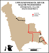
This data file contains Interstate, US, and Minnesota State highways for the Upper Minnesota River Major Watershed. These data are selected from the State of Minnesota BaseMap '98 (Mn/DOT) "HWY" data file in which the dynamic segmentation route model is used. The "HWY" data file has been modified with the ROUTEARC and CLEAN commands for the purpose of transferring highway names to the arc attribute table (.aat).
|
hwy22m [ Interstate, US, and Minnesota state highways ]
 Click to enlarge |
This data file is similar to hwy22 (above). An identity has been performed with the minor watershed (mshed22) file for the purpose of joining the unique five digit minor watershed ID to facilitate ArcView users in the reselection process. This data file contains the combined attributes of both files.
|
roads22 [ Highways, Roads, and Streets ]
 Click to enlarge |
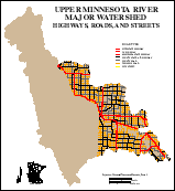
This data file contains all roads from the State of Minnesota BaseMap 98 (Mn/DOT) for the Upper Minnesota River Major Watershed. Road types include: Interstate, US highways, Minnesota State highways, County State-aid highway, County roads, Township roads, and city streets.
|
roads22m [ Highways, Roads, and Streets ]
 Click to enlarge |
This data file is similar to roads22 (above). An identity has been performed with the minor watershed (mshed22) file for the purpose of joining the unique five digit minor watershed ID to facilitate ArcView users in the reselection process. This data file contains the combined attributes of both files.
|
Return to top of page
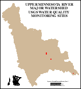
usgsqw22 [ USGS water quality monitoring sites ]
 Click to enlarge |
This data file contains point locations for USGS water quality monitoring sites within the Upper Minnesota River Major Watershed.
|
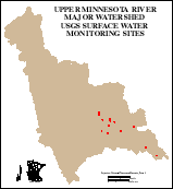
usgssw22 [ USGS surface water monitoring sites ]
 Click to enlarge |
This data file contains point locations for USGS surface water monitoring sites within the Upper Minnesota River Major Watershed.
|
pcabio22 [ MPCA biological monitoring sites ]
 Click to enlarge |
This data file contains point locations for MPCA biological monitoring sites within the Upper Minnesota River Major Watershed.
|
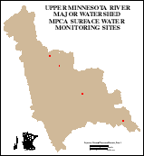
pcamon22 [ MPCA surface water monitoring sites ]
 Click to enlarge |
This data file contains point locations for MPCA surface monitoring sites within the Upper Minnesota River Major Watershed.
|
Return to top of page
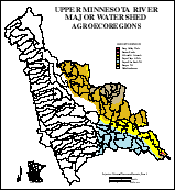
agroec22 [ Agroecoregions ]
 Click to enlarge |
This data file contains Agroecoregions within the Upper Minnesota River Major Watershed. The minor watershed (mshed22) file is joined to facilitate ArcView users in the reselection process.
|
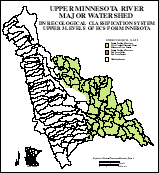
dnrecs22 [ DNR Ecosystems ]
 Click to enlarge |
This data file contains Minnesota DNR Ecosystems within the Upper Minnesota River Major Watershed. The minor watershed (mshed22) file is joined to facilitate ArcView users in the reselection process.
|
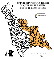
ecoreg22 [ MPCA Ecoregions ]
 Click to enlarge |
This data file contains Minnesota Ecoregions within the Upper Minnesota River Major Watershed. The minor watershed (mshed22) file is joined to facilitate ArcView users in the reselection process.
|
Return to top of page
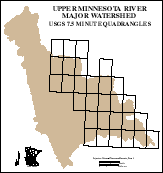
q24m22 [ USGS 7.5 minute quadrangles ]
 Click to enlarge |
The Upper Minnesota River Major Watershed is contained within 42 U.S. Geological Survey 7.5 minute series topographic maps fot the state of Minnesota. This data file contains boundaries and polygon attributes for the quadrangle maps.
|
Return to top of page
Return to

