Minnesota River Virtual Tour - Big Stone Lake
|
|
||||||
|
Stop 1 - Big Stone Lake (River Mile 335) |
||||||
 |
 |
|||||
 |
||||||
|
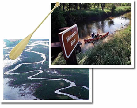
The start of the Minnesota River, near Ortonville and Big Stone Lake, is a marshy expanse with the river channel winding through the reeds. |
||||||
|
Headwaters of the Minnesota River Our first stop is the headwaters of the Minnesota River Basin. The source of the mighty Minnesota River is a small stream, about 25 feet wide and a foot deep, near the Minnesota and South Dakota border. |
||||||
 |
Headwater streams are typically the smallest streams in the watershed. They form from surface runoff, melting snow, or groundwater that seeps out to the surface as springs. Throughout the entire Minnesota River Basin, hundreds of headwater streams feed tributary rivers which join the main stem of the Minnesota River. The River will increase in size and volume as we move downstream. From headwaters to the confluence, we'll be traveling 335 river miles and dropping 274 feet in elevation (stream profile). | |||||
| Big Stone Lake Overlook | ||||||
| | map | 1 | 2 | 3 | 4 | 5 | 6 | 7 | 8 | 9 | 10 | 11 | 12 | basin overview | home | |
|
|||||
