Water Storage Current Land Use

Photo credit: Rietz, N. D., and Water Resources Center MNSU – Mankato, Blue Earth River Major Watershed Land Use Map
There is a long history of human settlement in the Minnesota River Basin. The vast prairie and wetland complexes provided fertile soil for animals to live off the plants and for people to begin farming the soil, leading to the foundation for the predominant land use as agriculture. According to the latest MPCA reporting, over 80 percent of the land area in the Minnesota River Basin is used for various types of farming. In the Minnesota River Basin the large agricultural land use suggests the prime opportunity for potential water storage conservation practices is on that land. While the predominant opportunity does lie with agricultural land (UMN’s BMP Handbook), every practice to increase water storage on the land surface is important, and urban populations (MPCA’s Citizen Guide to Stormwater) can contribute as well.
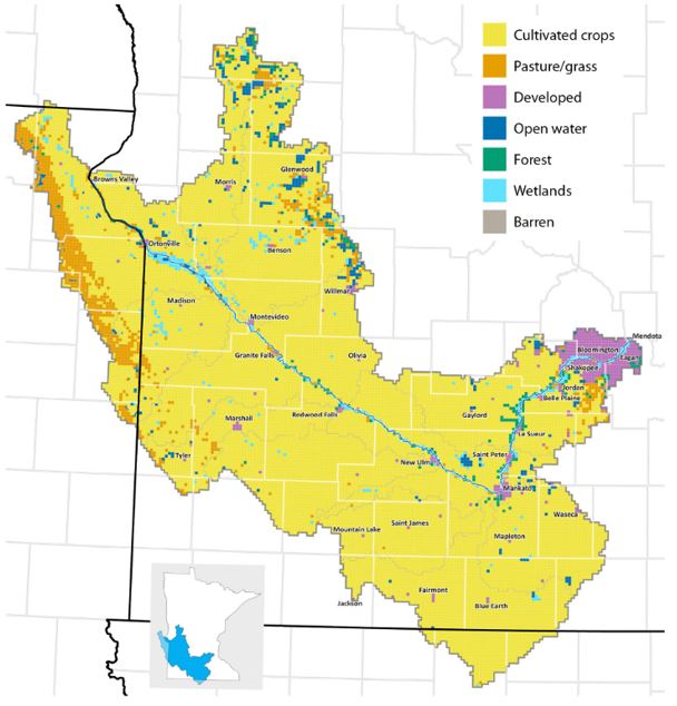
Photo credit: Minnesota Pollution Control Agency, 2019, Water: Minnesota River Basin, flickr: https://www.flickr.com/photos/mpcaphotos/albums/72157709746428481
An increase in farming also increased the innovations to be able to farm. Innovations occurred above and below the soil surface, from plows to combines for tilling the soil, and ceramic tiles to PVC pipes for draining the soil. The history of tiling in Minnesota to drain soil can be found condensed in the White Paper Drain Tiles and Groundwater Resources. Along with below surface tiles, the drained water then moves to above ground ditch systems that eventually reach the various rivers and creeks. Over the past century, there has been more and more tile and ditch drainage installed in the landscape. While the drainage has, in the past, been a good practice to be able to farm more areas of land, the increasing rain over the last several decades has shown some areas (including previous wetland areas, shown in the Wetland Inventory through the DNR; as well as soils with low permeability and drained shallow lake beds) that are more and more difficult to drain. Along with the decreasing ability to drain parts of the soil, the water that is leaving is increasing in frequency and intensity. This causes property loss and infrastructure damage to land downstream. One way to combat both of these issues is to place temporary or permanent water storage on the land surface. A summary of land use, tiling and effect on water quality issues can be found in Field to Streams: Managing Water in Rural Landscapes. Part One, Water Shaping the Landscape and Part Two, Managing Sediment and Water by Ann Lewandowski and associates at the Water Resources Center, University of Minnesota.
More resources:
Quantification of tiling
https://bwsr.state.mn.us/sites/default/files/2018-12/tile_evaluation-Rick_Moore7-29-09.pdf
US Drainage history from NRCS
https://www.nrcs.usda.gov/wps/portal/nrcs/main/national/water/manage/drainage/
More land use maps from MRBDC