Jump to Content

Secondary menu

  • Media Center
  • Contacts
  • Calendar
  • Log in

Search form

  • Basin
    • Fast Facts
      • What is a watershed?
      • Watersheds Across Scales
      • Minnesota River Profile
      • Minnesota River Virtual Tour
    • History
      • Timeline
      • Steamboating
      • Place Names
      • Historic Images
    • Geology
      • Glaciation
      • Valley Formation
    • Hydrology
      • Flooding
    • Landscape & Wildlife
      • Bird Photos
      • Fish Photos
      • Mammal Photos
      • Prairies
      • Wetlands
      • What is it?
    • River Stories
      • Art & Barb Straub
      • Bob Smith
      • Brand Frentz & Joe Michel
      • Charles Smith
      • Dave Craigmile
      • Del & Shirley Wehrspann
      • John Fritsche
      • Richard Handeen & Audrey Arner
    close this panel
  • Watersheds
    • Blue Earth
      • Chippewa
        • Cottonwood
          • Hawk Creek - Yellow Medicine
            • Lac qui Parle
              • Le Sueur
                • Lower Minnesota
                  • Middle Minnesota
                    • Pomme de Terre
                      • Redwood
                        • Upper Minnesota
                          • Watonwan
    close this panel
  • Reports
      close this panel
    • Maps & GIS
      • Printable Maps
        • Basin Maps
        • Watershed Overview Maps
        • Land Use Maps
        • Impaired Waters Maps
      • Interactive Maps
          • Ask An Expert 360° Virtual Tours
            • Geologic Atlas - 13 County
              • Minnesota Tillage Transect Survey Data Center
                • Surface Water Hydrology Atlas - 13 County
                  • Southern MN Tile Monitoring Project
      close this panel
    • Make a Difference
      • Restoration
        • In the City
        • On the Farm
        • Water Storage
      • Get Involved
        • Nonprofit Organizations
        • Watershed Districts
        • Watershed Projects
        • State-wide Groups
        • National Groups
        • Universities & Colleges
        • American Indian Com.
        • SWCDs
        close this panel
      • Explore
        • Mystery / Intriguing Sites
          • Historical / Cultural Sites
            • Fishing
              • Swimming
                • Paddling
                  • Camping
                    • Hiking
                        • Biking
                          • Horseback Riding
                            • Bird Watching
                              • Hunting
        close this panel
      • Water Quality
        • WQ Overview
          • Monitoring
          • Monitoring Data
          • Impaired Waters
          • Pollutants
          • Trends Report
          • State of the Minnesota River
          • Progress Report
          • Downtream Impacts
          • Minnesota to Mississippi
        close this panel
      • Learn
          • Meet the Experts
            • Landscape History
              • Geology
              • Prairies
              • Wetlands
            • Landscape Today
              • Agriculture
              • Water Quality
                • Monitoring
                • Impaired Waters
                • Sediment
                • Phosphorus
                • Nitrogen
                • Downstream Impacts
              • Bio-Indicators
                • Fish
                • Mussels
                • Macroinvertebrates
              • Making a Difference
                • Pollution Problems
                • Clean Up Solutions
                • Case Studies
                • Voices of the River
          close this panel

        You are here

        Home » Learn » Water Quality

        Impaired Waters


        IMPAIRED WATERS VIDEOS
        What is the 303(d) list?  What is the 303(d) list? (01:18 minutes) 

        What are impaired waters?  
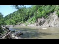
What are impaired waters? (00:48)

        What is a TMDL (Total Maximum Daily Load) Study?  What is a TMDL (Total Maximum Daily Load) Study? (01:45) 

        What is a TMDL and how does it relate to water quality issues?  What is a TMDL and how does it relate to water quality issues? (03:09)

        What is a typical TMDL (Total Maximum Daily Load) process?  What is a typical TMDL (Total Maximum Daily Load) process? (01:49) 

        What is MPCA's approach to address impaired waters in the Minnesota River Basin?  What is MPCA's approach to address impaired waters in the Minnesota River Basin? (01:31) 

        What is the status of impaired waters in the Minnesota River Basin?  What is the status of impaired waters in the Minnesota River Basin? (01:02)

        What happens after a TMDL (Total Maximum Daily Load) study?  What happens after a TMDL (Total Maximum Daily Load) study? (00:54) 

        How does the number of impaired waters in the Minnesota River Basin compared to other basins in the state?  How does the number of impaired waters in the Minnesota River Basin compared to other basins in the state? (01:19)

        MEET THE EXPERTS
        Bob Finley - Regional Manager, Minnesota Pollution Control Agency  
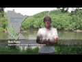
Bob Finley – Regional Manager, Minnesota Pollution Control Agency


        FACT SHEETS
        Impaired Waters Overview (pdf)

        FEATURES & MEDIA
        360 Panoramic Tour 
        Slideshow


        MEET THE EXPERTS
        Pat Baskfield, Hydrologist, MPCA

        Bob Finley - Regional Manager, MPCA

        RESOURCES
        MPCA Impaired Waters List
        (MPCA web link)
        MPCA Impaired Waters & TMDLs
        (MPCA web link)
        Minnesota River Turbidity TMDL
        (MPCA web link)
        Minnesota River TMDL Projects (MPCA web link)


        Minnesota River Basin Data Center | Minnesota State University, Mankato
        189 Trafton Science Center S, Mankato, MN 56001 | Phone: (507) 389-5492 | FAX: (507) 389-5493 | Email: mrbdc@mnsu.edu
         
        Built by Ben Harris | Powered by Drupal