Jump to Content

Secondary menu

  • Media Center
  • Contacts
  • Calendar
  • Log in

Search form

  • Basin
    • Fast Facts
      • What is a watershed?
      • Watersheds Across Scales
      • Minnesota River Profile
      • Minnesota River Virtual Tour
    • History
      • Timeline
      • Steamboating
      • Place Names
      • Historic Images
    • Geology
      • Glaciation
      • Valley Formation
    • Hydrology
      • Flooding
    • Landscape & Wildlife
      • Bird Photos
      • Fish Photos
      • Mammal Photos
      • Prairies
      • Wetlands
      • What is it?
    • River Stories
      • Art & Barb Straub
      • Bob Smith
      • Brand Frentz & Joe Michel
      • Charles Smith
      • Dave Craigmile
      • Del & Shirley Wehrspann
      • John Fritsche
      • Richard Handeen & Audrey Arner
    close this panel
  • Watersheds
    • Blue Earth
      • Chippewa
        • Cottonwood
          • Hawk Creek - Yellow Medicine
            • Lac qui Parle
              • Le Sueur
                • Lower Minnesota
                  • Middle Minnesota
                    • Pomme de Terre
                      • Redwood
                        • Upper Minnesota
                          • Watonwan
    close this panel
  • Reports
      close this panel
    • Maps & GIS
      • Printable Maps
        • Basin Maps
        • Watershed Overview Maps
        • Land Use Maps
        • Impaired Waters Maps
      • Interactive Maps
          • Ask An Expert 360° Virtual Tours
            • Geologic Atlas - 13 County
              • Minnesota Tillage Transect Survey Data Center
                • Surface Water Hydrology Atlas - 13 County
                  • Southern MN Tile Monitoring Project
      close this panel
    • Make a Difference
      • Restoration
        • In the City
        • On the Farm
        • Water Storage
      • Get Involved
        • Nonprofit Organizations
        • Watershed Districts
        • Watershed Projects
        • State-wide Groups
        • National Groups
        • Universities & Colleges
        • American Indian Com.
        • SWCDs
        close this panel
      • Explore
        • Mystery / Intriguing Sites
          • Historical / Cultural Sites
            • Fishing
              • Swimming
                • Paddling
                  • Camping
                    • Hiking
                        • Biking
                          • Horseback Riding
                            • Bird Watching
                              • Hunting
        close this panel
      • Water Quality
        • WQ Overview
          • Monitoring
          • Monitoring Data
          • Impaired Waters
          • Pollutants
          • Trends Report
          • State of the Minnesota River
          • Progress Report
          • Downtream Impacts
          • Minnesota to Mississippi
        close this panel
      • Learn
          • Meet the Experts
            • Landscape History
              • Geology
              • Prairies
              • Wetlands
            • Landscape Today
              • Agriculture
              • Water Quality
                • Monitoring
                • Impaired Waters
                • Sediment
                • Phosphorus
                • Nitrogen
                • Downstream Impacts
              • Bio-Indicators
                • Fish
                • Mussels
                • Macroinvertebrates
              • Making a Difference
                • Pollution Problems
                • Clean Up Solutions
                • Case Studies
                • Voices of the River
          close this panel

        You are here

        Home » Learn » Water Quality

        Monitoring


        MONITORING VIDEOS

        Who monitors water quality in the Minnesota River Basin?  Who monitors water quality in the Minnesota River Basin? (02:35 minutes) 

        What monitoring equipment is used in the Minnesota River Basin?  
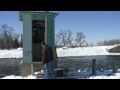
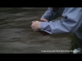
What monitoring equipment is used in the Minnesota River Basin? (02:08) 

        Why is water quality monitoring important in the Minnesota River Basin?  Why is water quality monitoring important in the Minnesota River Basin? (01:38) 

        What are the major water quality problems in the Minnesota River Basin?  What are the major water quality problems in the Minnesota River Basin? (01:53)

        How does water quality in the Minnesota River Basin compare with other basins in the state?  How does water quality in the Minnesota River Basin compare with other basins in the state? (01:35) 

        What is the current condition of water quality in the Minnesota River Basin?  What is the current condition of water quality in the Minnesota River Basin? (00:58) 

          Is Minnesota River Basin water quality improving? (01:17) 

        Is there a difference in water quality among the tributaries of the Minnesota River Basin?  Is there a difference in water quality among the tributaries of the Minnesota River Basin? (02:03) 

        What is the significance of the water quality in the Greater Blue Earth River?  What is the significance of the water quality in the Greater Blue Earth River? (01:38) 

        Do any water quality monitoring results in the Minnesota River Basin stand out?  Do any water quality monitoring results in the Minnesota River Basin stand out? (01:58) 

        Have you noticed a difference since monitoring water quality in the Minnesota River Basin?  Have you noticed a difference since monitoring water quality in the Minnesota River Basin? (01:18)


        MEET THE EXPERT

        Pat Baskfield, Hydrologist, MPCA  
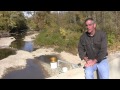
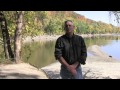
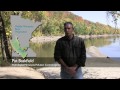
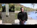
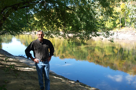
Pat Baskfield – Hydrologist, Minnesota Pollution Control Agency

        FACT SHEETS
        Monitoring Overview (pdf)

        FEATURES & MEDIA

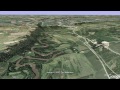
        360 Virtual Tour - Ravines and the Le Sueur River
        Slideshow

        MEET THE EXPERT
        Pat Baskfield, Hydrologist, MPCA

        RESOURCES
        To Access Water Quality Monitoring Data:
        State of the Minnesota River: Water Quality Monitoring Reports
        DNR/MPCA Cooperative Stream Gaging (MPCA web link)
        MPCA Water Quality Data: Environmental Data Access (MPCA web link)
        USGS Surface Water Data (USGS web link)
        MPCA Citizen Stream Monitoring Program (MPCA web link)
        MPCA Citizen Lake Monitoring Program (MPCA web link)

        305B Assessments of Stream Condition
        (MPCA web link)
        MPCA Watershed Approach (MPCA web link)
        Minnesota River Basin (MPCA web link)

        Minnesota River Basin Data Center | Minnesota State University, Mankato
        189 Trafton Science Center S, Mankato, MN 56001 | Phone: (507) 389-5492 | FAX: (507) 389-5493 | Email: mrbdc@mnsu.edu
         
        Built by Ben Harris | Powered by Drupal