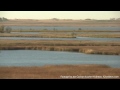
Jump to Content

Secondary menu

  • Media Center
  • Contacts
  • Calendar
  • Log in

Search form

  • Basin
    • Fast Facts
      • What is a watershed?
      • Watersheds Across Scales
      • Minnesota River Profile
      • Minnesota River Virtual Tour
    • History
      • Timeline
      • Steamboating
      • Place Names
      • Historic Images
    • Geology
      • Glaciation
      • Valley Formation
    • Hydrology
      • Flooding
    • Landscape & Wildlife
      • Bird Photos
      • Fish Photos
      • Mammal Photos
      • Prairies
      • Wetlands
      • What is it?
    • River Stories
      • Art & Barb Straub
      • Bob Smith
      • Brand Frentz & Joe Michel
      • Charles Smith
      • Dave Craigmile
      • Del & Shirley Wehrspann
      • John Fritsche
      • Richard Handeen & Audrey Arner
    close this panel
  • Watersheds
    • Blue Earth
      • Chippewa
        • Cottonwood
          • Hawk Creek - Yellow Medicine
            • Lac qui Parle
              • Le Sueur
                • Lower Minnesota
                  • Middle Minnesota
                    • Pomme de Terre
                      • Redwood
                        • Upper Minnesota
                          • Watonwan
    close this panel
  • Reports
      close this panel
    • Maps & GIS
      • Printable Maps
        • Basin Maps
        • Watershed Overview Maps
        • Land Use Maps
        • Impaired Waters Maps
      • Interactive Maps
          • Ask An Expert 360° Virtual Tours
            • Geologic Atlas - 13 County
              • Minnesota Tillage Transect Survey Data Center
                • Surface Water Hydrology Atlas - 13 County
                  • Southern MN Tile Monitoring Project
      close this panel
    • Make a Difference
      • Restoration
        • In the City
        • On the Farm
        • Water Storage
      • Get Involved
        • Nonprofit Organizations
        • Watershed Districts
        • Watershed Projects
        • State-wide Groups
        • National Groups
        • Universities & Colleges
        • American Indian Com.
        • SWCDs
        close this panel
      • Explore
        • Mystery / Intriguing Sites
          • Historical / Cultural Sites
            • Fishing
              • Swimming
                • Paddling
                  • Camping
                    • Hiking
                        • Biking
                          • Horseback Riding
                            • Bird Watching
                              • Hunting
        close this panel
      • Water Quality
        • WQ Overview
          • Monitoring
          • Monitoring Data
          • Impaired Waters
          • Pollutants
          • Trends Report
          • State of the Minnesota River
          • Progress Report
          • Downtream Impacts
          • Minnesota to Mississippi
        close this panel
      • Learn
          • Meet the Experts
            • Landscape History
              • Geology
              • Prairies
              • Wetlands
            • Landscape Today
              • Agriculture
              • Water Quality
                • Monitoring
                • Impaired Waters
                • Sediment
                • Phosphorus
                • Nitrogen
                • Downstream Impacts
              • Bio-Indicators
                • Fish
                • Mussels
                • Macroinvertebrates
              • Making a Difference
                • Pollution Problems
                • Clean Up Solutions
                • Case Studies
                • Voices of the River
          close this panel

        You are here

        Home » Learn » Landscape History

        Wetlands


        WETLAND VIDEOS

        What are the benfits of wetlands?  What are the benefits of wetlands? (01:48 minutes)

        What is the current status of wetlands in the Minnesota River Basin?  What is the current status of wetlands in the Minnesota River Basin? (01:50)

        What are the impacts of wetland drainage?  What are the impacts of wetland drainage? (01:12)

        What is the history of wetlands in the Minnesota River Basin?  What is the history of wetlands in the Minnesota River Basin? (01:09)

        Are wetlands currently protected?  Are wetlands currently protected? (02:48)  

        What are the threats to wetlands today?  What are the threats to wetlands today? (00:37)

        What is a wetland?  What is a wetland? (00:47)

        Why were wetlands drained in the Minnesota River Basin?  Why were wetlands drained in the Minnesota River Basin? (00:46)


        MEET THE EXPERTS

        Dr. Brad Cook, Associate Professor of Community Ecology, Minnesota State University, Mankato  
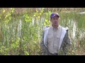
Dr. Brad Cook – Associate Professor of Community Ecology, MSU, Mankato

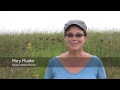
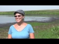
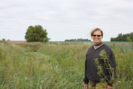
          Mary Mueller – Farmer Conservationist


        FACT SHEETS
        Wetland Overview (pdf)

        FEATURES & MEDIA
        ANIMATIONS (Requires the Flash Plugin)
        Wetland Loss (1.1 mb)

        Wetland Restoration (1.6 mb)

        Interactive Hydrograph (3.2 mb)
        Slideshow


        EDUCATIONAL MATERIALS
        Educators Guide
        Wetland PowerPoint

        MEET THE EXPERTS
        Dr. Brad Cook, Associate Professor of Community Ecology, Minnesota State University, Mankato


        Mary Mueller, Farmer Conservationist

        RESOURCES
        Wetland Plant Identification Guide (USGS web link)
        Minnesota Department of Natural Resources- Wetlands (MDNR web link)
        Wetland Quantity Baseline Report (MPCA web link)
        Depressional Wetland Quality Baseline Report (MPCA pdf)

         
        Minnesota River Basin Data Center | Minnesota State University, Mankato
        189 Trafton Science Center S, Mankato, MN 56001 | Phone: (507) 389-5492 | FAX: (507) 389-5493 | Email: mrbdc@mnsu.edu
         
        Built by Ben Harris | Powered by Drupal