MRBDC Le Sueur Major Watershed General Description
General Description
The Le Sueur River Major Watershed is one of the twelve major watersheds of the Minnesota River Basin. It is located in south central Minnesota within Blue Earth, Faribault, Freeborn, Le Sueur, Steele, and Waseca counties. There are 20 municipalities in the watershed of which the city of Waseca is the largest. The Le Sueur River major watershed area is approximately 1,112 square miles or 711,838 acres. The watershed is subdivided into 86 minor watersheds. The minor watersheds range in size from 1,381 acres to 19,978 acres with the mean size approximately 8,277 acres. Agriculture is the predominant land use within the watershed.
The Le Sueur River and its tributaries, public and private drainage systems, lakes and wetlands, define the drainage network of the major watershed. The Le Sueur River flows north and west to its confluence with the Blue Earth River south of the city of Mankato in Blue Earth County. The total distance of the stream network is 1,201 miles of which 703 miles are intermittent streams and 498 miles are perennial streams.
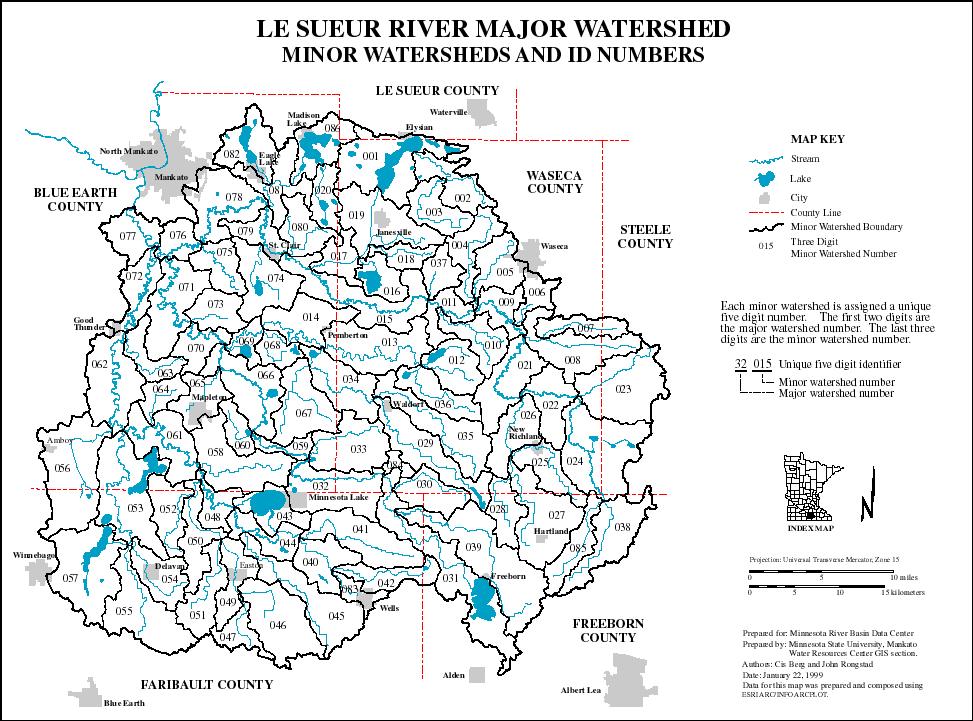
Map of Major Watershed 32
View, print or save PDF file of the Le Sueur River Major Watershed (849 K)
| Page Index | Next Page |
Return to