Chippewa Major Watershed General Description
General Description
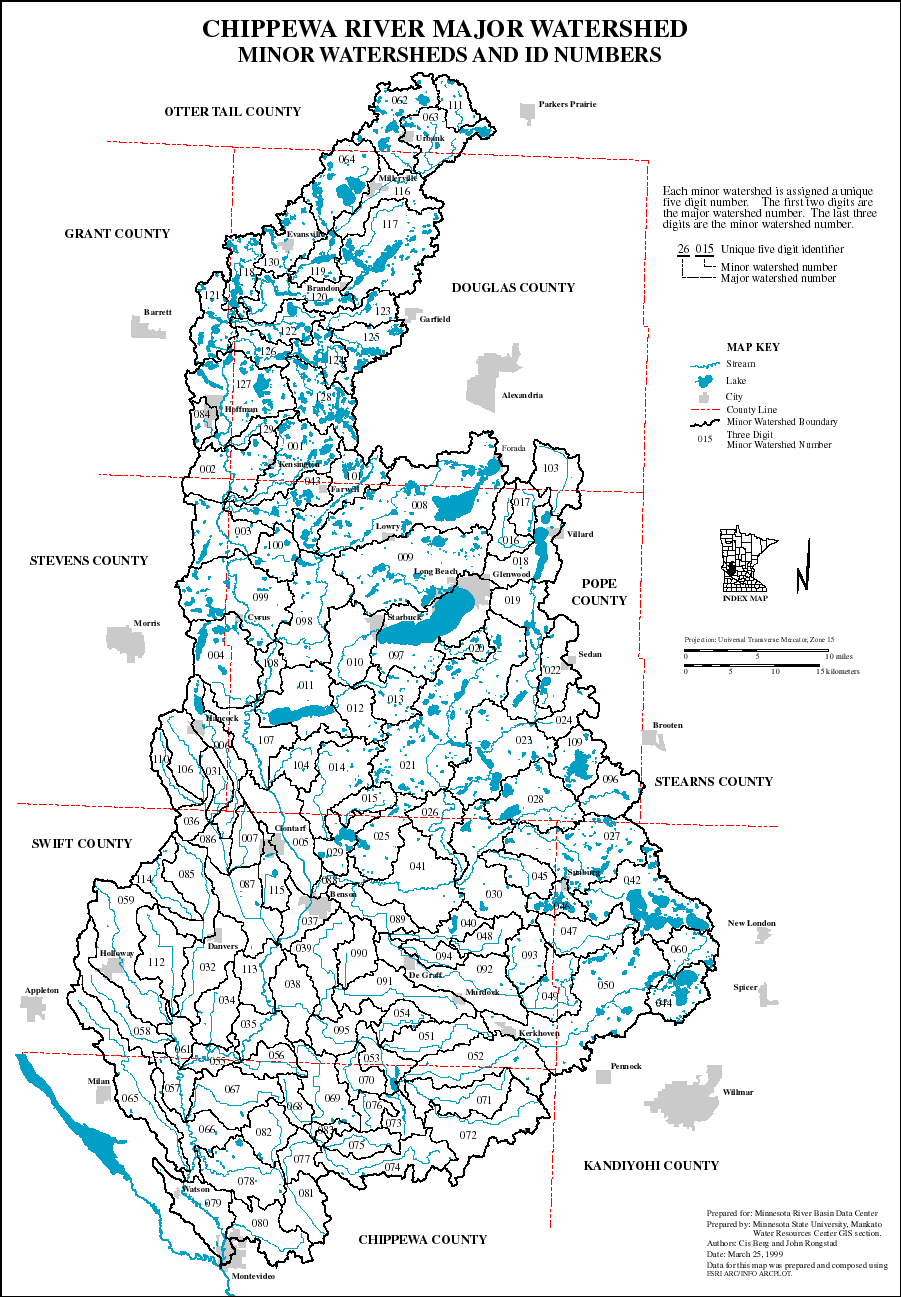
The Chippewa River Major Watershed is one of the twelve major watersheds of the Minnesota River Basin. It is located in west central Minnesota within Chippewa, Douglas, Grant, Kandiyohi, Otter Tail, Pope, Stearns, Stevens and Swift counties. There are 26 municipalities in the watershed of which the city of Montevideo is the largest. The Chippewa River major watershed area is approximately 2,084 square miles or 1,333,541 acres. The watershed is subdivided into 127 minor watersheds. The minor watersheds range in size from 1,644 acres to 40,351 acres with the mean size approximately 10,500 acres. Agriculture is the predominant land use within the watershed.
The Chippewa River and its tributaries, public and private drainage systems, lakes and wetlands, define the drainage network of the major watershed. The Chippewa River flows south to its confluence with the Minnesota River at Montevideo in Chippewa County. The total distance of the stream network is 2,091 miles of which 1,567 miles are intermittent streams and 525 miles are perennial streams.
View, print or save PDF file of the Chippewa River Major Watershed (1,731 K)
| Page Index | Next Page |