![]()
Stop
1: Headwaters
Watershed defined
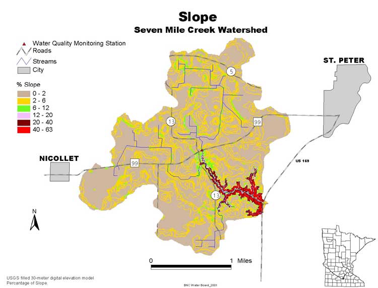
Slope map
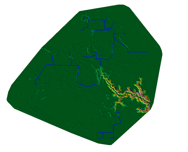
3D Slope map
Stream profile
Watersheds across scales
Stop
2: Red Top Farm
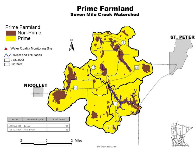
Prime farmland map
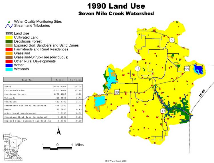
Land use map (1990)
Stop
3: Oak Leaf Lake
Presettlement vegetation map
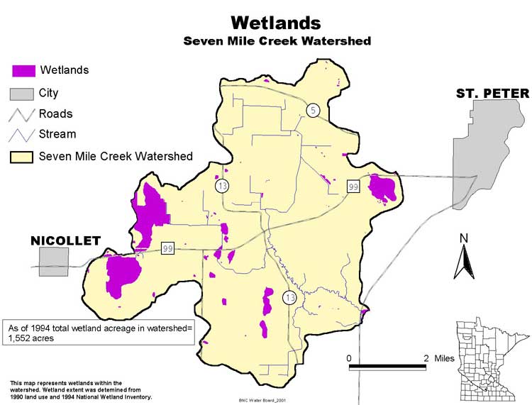
Existing wetlands map
Wetland Project
Natural versus altered drainage map
Stop
4: Water Quality Monitoring Site #1
Hydrograph
Stop
5: Monitoring Site #2
Sediment and nutrient sources
Stop
6: Outdated Septic Systems
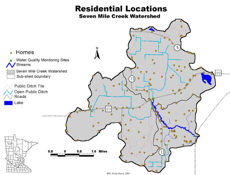
Residential location map
Potentially failing septic systems
Stop
7: Best Management Practices (BMPs)
Best management practices
Stop
8: Seven Mile Creek Park
Park trail map
Interactive map
Fishery rehabilitation/Streambank protection
project
Trout information
Stop
9: Seven Mile Creek Park
Geologic history
Plants
Bird list
Rare features
Park history
Park map
Stop 10: Confluence with Minnesota River
Minnesota-Mississippi map
Brown Nicollet Cottonwood
Water Quality Board Website
Minnesota River Basin Data Center Website
Credits