
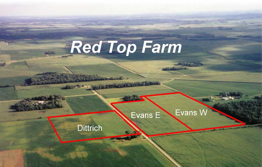
Red
Top is an example of a crop farm in the watershed. Agriculture is the
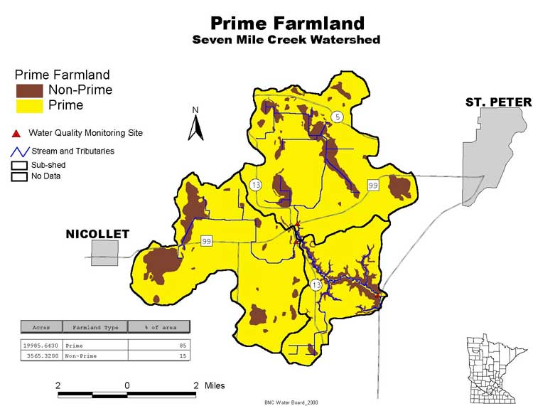
primary land use due to the prime farmland (map).
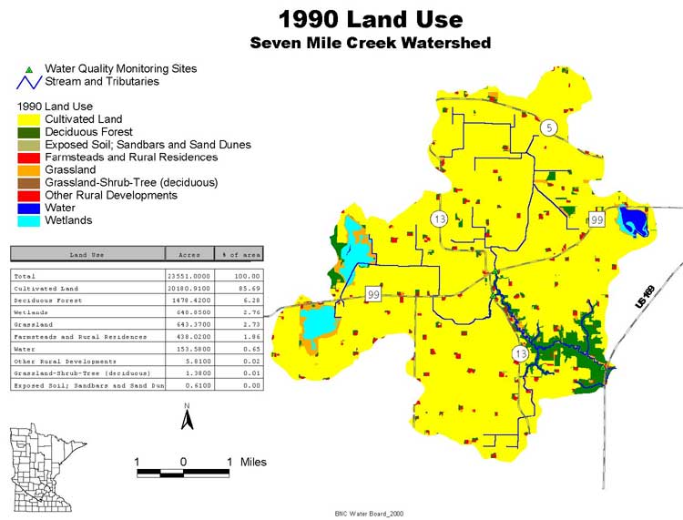
Approximately 86 percent of the watershed is under corn and soybean cultivation
while 6 percent is deciduous forest, and the remaining is wetlands, grassland,
and farmsteads (land use map). A unique
water quality demonstration project is under way in the watershed at Red
Top Farm.
"If there is something coming out of my tile lines I want to
be the first to know about it" says Rob Meyer, a Oshawa Township
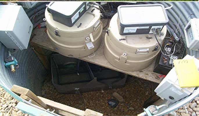
landowner. His Red Top Farm fields are being continuously monitored for
water quality as part of an agricultural research project. This ninety-acre
research field provides a unique opportunity to study the quality and
quantity of water and agricultural chemicals moving through the subsurface
tile drainage system.
Using simple conservation practices to reduce nitrogen leaching into groundwater
and surface water resulted in a significant reduction in fertilizer inputs,
maintained yields, and appears to have decreased nitrogen losses by 40
to 50 percent. Additionally, the results have been extremely positive
for the majority of pesticide products that have been studied since 1996.
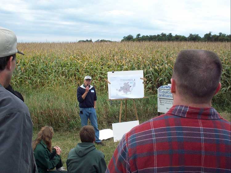
The overall concept of Red Top Farm has proven to be a highly effective
educational approach for farmers, agricultural professionals, and the
non-agricultural community. The site has hosted many educational field
days and has been featured in numerous agricultural magazines and newspaper
articles. Next
BNC home | mrbdc home | web site map |