
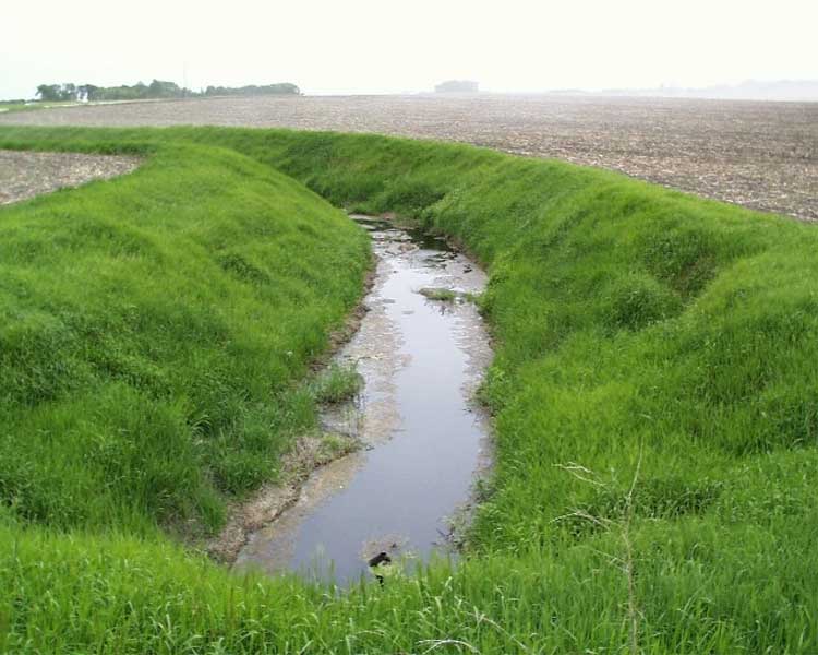
In the early to mid 1900s many of the small headwater streams were converted to drainage ditches. This drainage network helped to convert the wet clay soils into some of the best farm land in the county and region. Three primary ditches eventually flow into Seven Mile Creek, the largest waterway in this 23,551 acre (36.8 square miles) watershed.
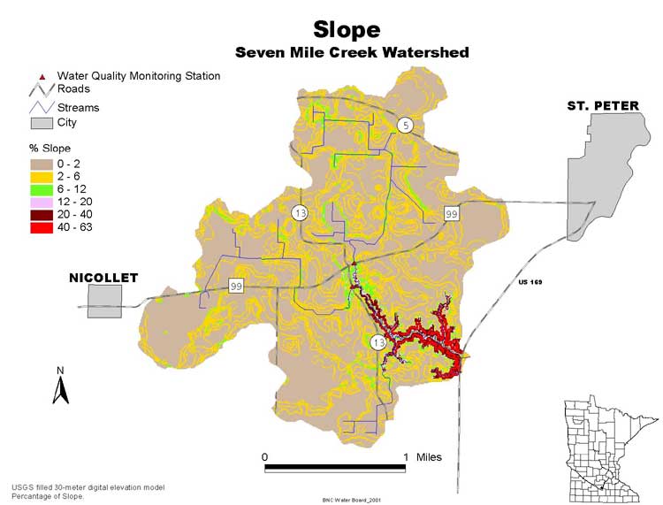
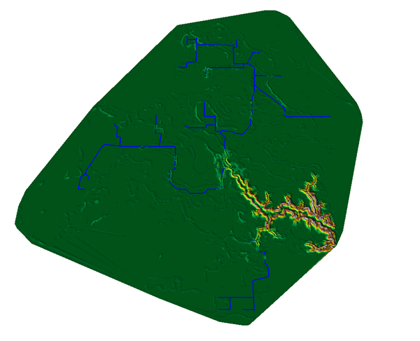
Most of the watershed is nearly level, but the slope map (3d slope map) shows the steep valley in the lower portion of the watershed, as the creek descends into the Minnesota River Valley (stream profile).
Seven Mile Creek is a minor watershed within the Minnesota River Basin. Many people in the area are familiar with this lower portion of the watershed because of the popular 628-acre Seven Mile Creek County Park. The last few stops on the tour explore the park and the tour ends where Seven Mile Creek flows into the Minnesota River.
Ever
wonder how Seven Mile Creek got its name? Early settlers named it Seven
Mile because the crossing was roughly seven miles from the county courthouse
by way of a trail that is now Highway 99. Next
Seven
Mile Creek is fed by three major drainage ditches.
BNC home | mrbdc home | web site map |