
Presettlement
Approximately 50 percent of the watershed is covered in wetlands
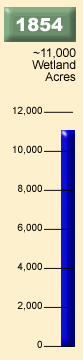
- Researchers
estimate that approximately 48 percent (11,000 acres) of the watershed
was covered by wetlands before settlement. The other half was considered
prairie, big woods, and oak openings. The Seven Mile Creek Watershed
totals approximately 23,551 acres (36.8 square miles).
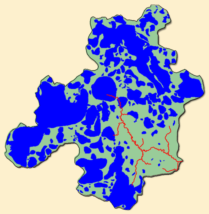
- A Public
Land Survey was conducted in Nicollet County (see image at left). These
maps also provide insight of what the watershed once looked like. These
maps along with soils and elevation information helped create the 1854
wetlands maps depicted above.
- Early
settlers’ descriptions indicated that the area was so wetland-rich
that one could paddle by canoe from just west of St. Peter to Swan Lake
(scroll over map for location).
- St. Peter, located just east of the watershed, is one of the oldest cities in Minnesota and was founded by Captain William D. Dodd in 1853.
The photo
on the left shows an aerial view of Swan Lake, a large prairie pot-hole
wetland located nearby. The image gives insight of what half the watershed
may have looked like before it was drained. Next

an example of what
more than half of the
watershed looked like in
the 1800s.
