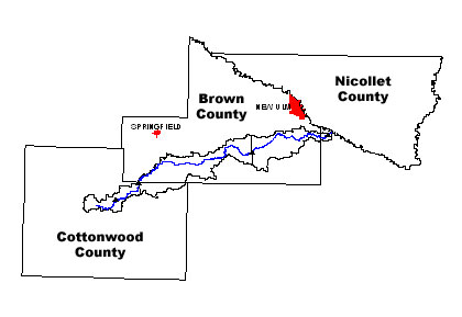
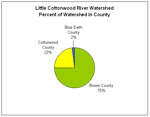
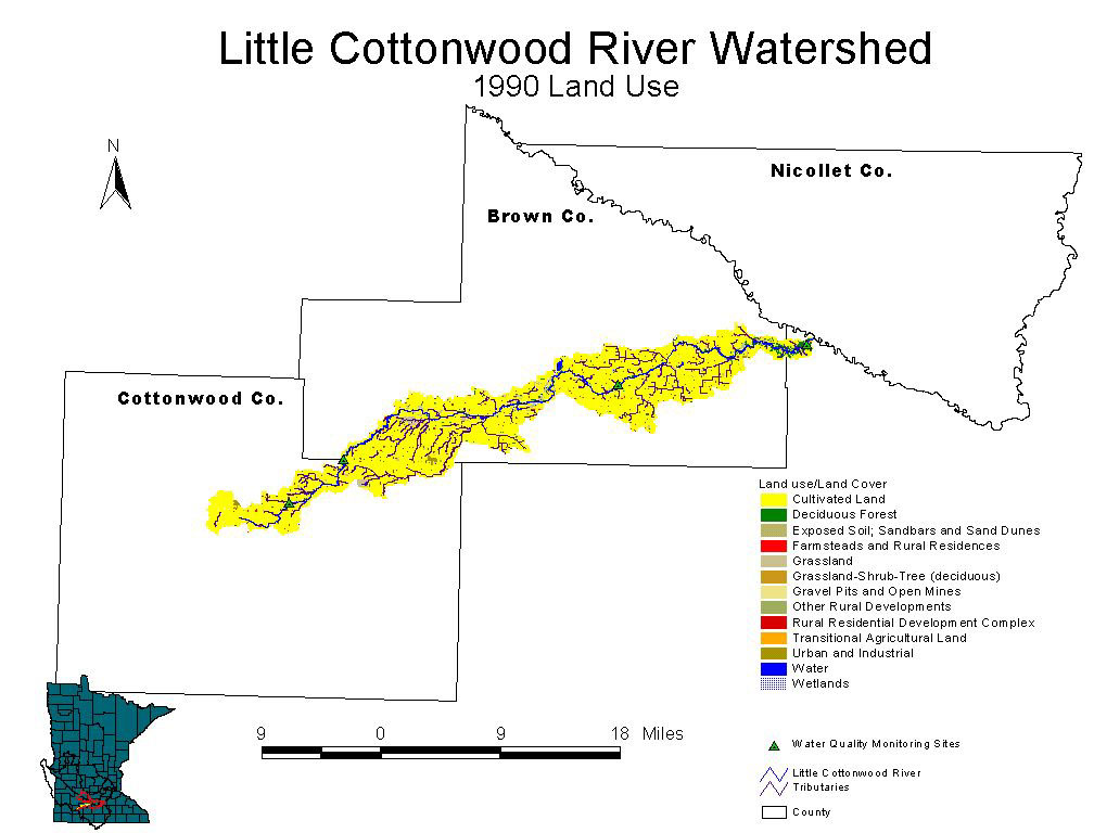
The Little Cottonwood River Watershed encompasses a strip of land along the river that spans three counties (map, chart) and covers 108,757 acres (170 square miles).
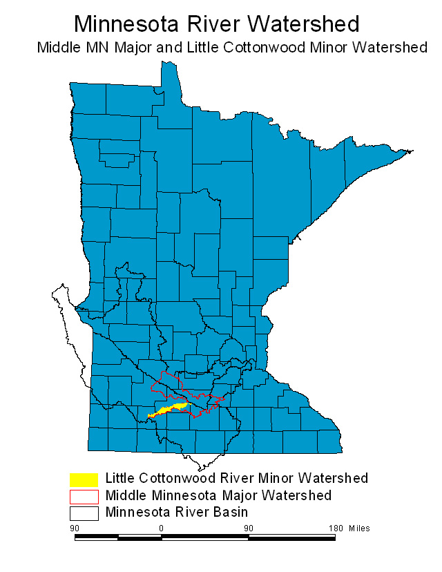
The watershed is part of the Middle Minnesota Major Watershed of the Minnesota River Basin in south-central Minnesota (location map). Nearly all of the rain and snow that falls into this watershed (gray area of the map above) eventually reaches the Little Cottonwood River.
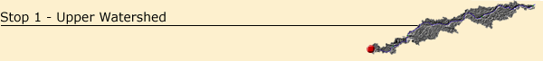
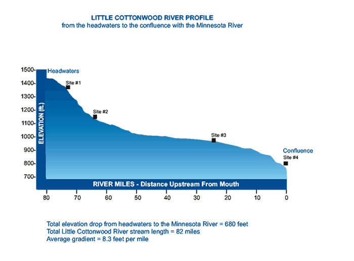
The first stop on the tour of the Little Cottonwood River Watershed is near the small community of Jeffers at the headwaters. Here the river begins its 80-mile course to the Minnesota River (stream profile). The source of the Little Cottonwood River is a large county drainage ditch (JD 9) that was constructed in 1997. The ditch, along with a system of underground drainage tiles, drains the upper portion of the watershed for crop production.
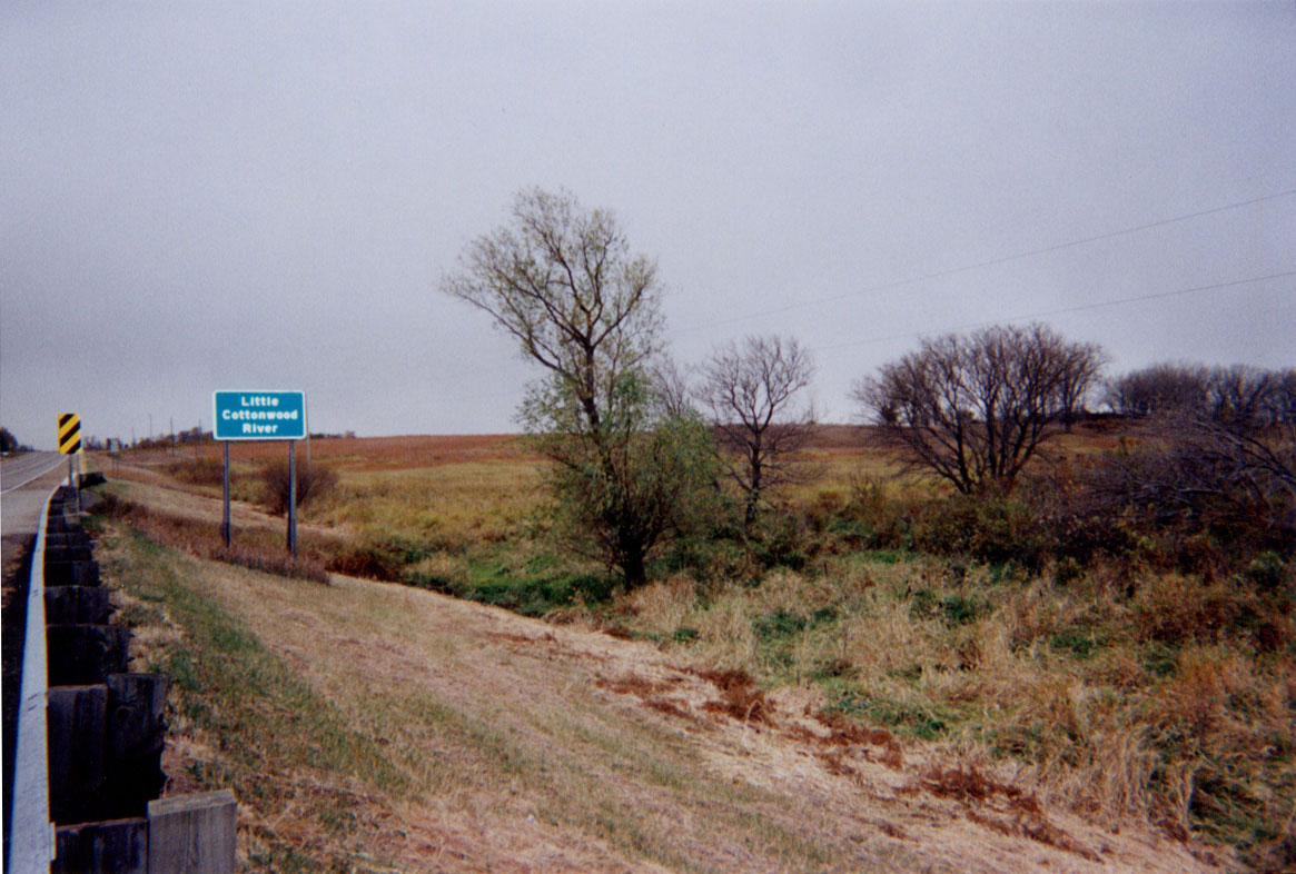
The upper portion of the watershed is especially scenic, with rock outcrops and a swiftly flowing river. The watershed is steep in this area, resulting in ‘flashy’ stream flow conditions. This means that after even moderate rainfall, the Little Cottonwood rises quickly and experiences a correspondingly rapid drop in level as the rain stops.
Most of the
lower part the watershed is level to gently rolling agricultural lands.
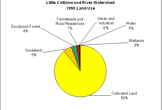
More than 90 percent of the watershed is under cultivation (land
use map, land use chart), and
is nearly all privately owned except for state-owned wildlife management
areas. Most areas in the watershed would be impossible to farm without
artificial drainage. Although efficient at draining the land, the network
of drainage systems can effect poor water quality by carrying unwanted
sediments and crop nutrients to the river and increasing flooding along
the river. High nitrate concentrations are found in the lower part of
the watershed. Next


entering the Little Cottonwood Watershed