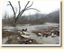
Stop 10 on the virtual tour of the Little Cottonwood River is its confluence with the Minnesota River, south of Courtland, Minnesota. Flooding is a major concern in the watershed. The picture on the right, taken in April 2001 during winter snowmelt, shows flooding near a county bridge. Over the past decade, farmers and landowners in the middle and lower watershed have experienced increasingly devastating and frequent flooding of their land.
As the Little Cottonwood River enters its lower reaches, between water quality Monitoring Sites #3 and #4 (river profile), sediment and nutrient loads increase significantly. The steep slopes and river gradient of this area, in combination with higher rainfall and runoff rates, contribute considerably to these overall increases. Using Best Management Practices within this area should be a priority.
Although the virtual tour of Little Cottonwood River Watershed ends here, the water continues to flow down the Minnesota River, joins the Mississippi River near St. Paul, and ultimately drains into the Gulf of Mexico (maps).
We hope you
enjoyed the virtual tour of the Little Cottonwood River and that you choose
to get involved or set out to explore this scenic watershed on your own.
Many organizations and individuals are working across the watershed to
protect and enhance the Little Cottonwood River. Many things, however,
remain to be done. If you would like to learn more or get involved, contact
the Brown Nicollet Cottonwood project coordinator, Kevin Kuehner, at 507-934-4140
or via e-mail at <kuehnbnc@hickorytech.net>.
Do you want to learn more about the Little Cottonwood River Watershed?
Visit the Brown Nicollet
Cottonwood Water Quality Board website.
Want to learn more about the Minnesota River Basin?
Visit the Minnesota River Basin Data Center
website.
Virtual Tour Credits.
Next

