
Monitoring results have shown that water moves quickly off the landscape and into the creek. Seven Mile Creek is considered a "flashy" watershed. In other words, after rain or snowmelt, the creek rises quickly but then recedes just as fast. "Flashy" watersheds typically have more stream bank erosion. There are many different factors that cause bank erosion including climate, soils, topography, and land use. In the case of Seven Mile Creek watershed, changes in land use such as draining wetlands can accelerate bank erosion. See hydrograph for more information.
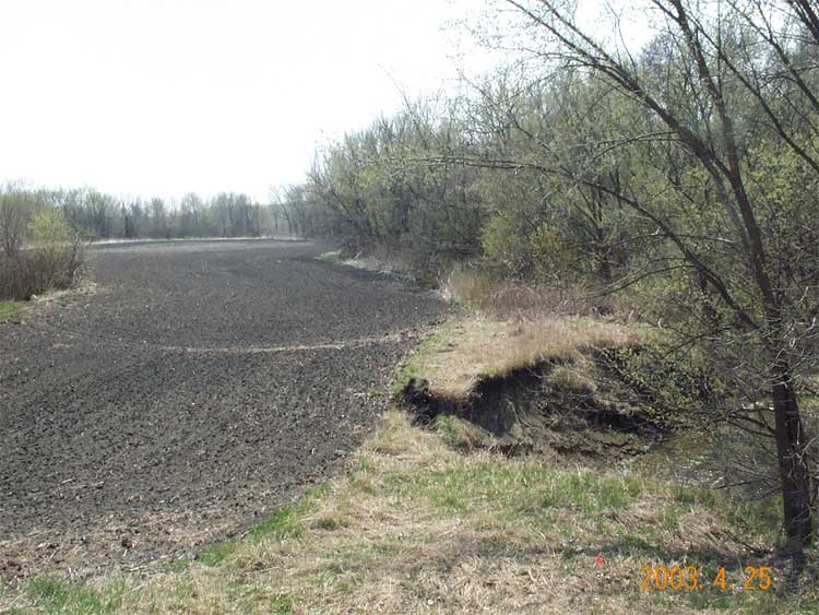
The stream banks of Seven Mile Creek near Monitoring Site #1 are an example of stream bank erosion occuring (see photo right top). The stream bank is eroding because it is adjusting to the increased volume of water from a drainage ditch. The stream Monitoring Site #1 is located downstream of Highway 99 west of St. Peter. Next

Typical
flow (April 2000)
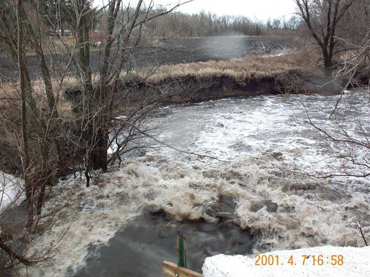
High
flow, spring snowmelt (April 2001)
Water moves quickly off the landscape
due to extensive drainage ditches
and underground tiling .
Water moves quickly off the landscape
due to extensive drainage ditches
and underground tiling .

High
flow, summer rain (June 2002)
BNC home | mrbdc home | web site map |