Seven Mile Creek Watershed
Publications
An Historical Perspective of Hydrologic Changes - 2004 (pdf 474 k)
An Historical Perspective of Hydrologic Changes (Powerpoint presentation 16,524 k)
Farming a Different Crop - Wetlands (pdf 413 k)
Featured Articles
Restored Marsh Helps Clean Creek - November 11, 2004 (pdf 23 k)
Website
Wetlands in the Seven Mile Creek Watershed
Wetlands
were once a dominant feature of the prairie landscape in South-Central
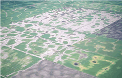
Minnesota. Today, fewer than 10% of the original wetlands exist as a result
of our intensive efforts to drain the fertile land for agricultural production.
Although not all of the consequences of these changes are understood,
they are thought to include water quality degradation, increased flood
frequency and intensity along rivers and major tributaries, and loss of
critical habitat and diversity for wildlife.

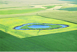
Recently, the Seven-Mile Creek Watershed Project with funding from the McKnight Foundation are exploring ways to restore wetlands while maintaining agricultural productivity and profitability. Innovative solutions include linking wetlands to subsurface drainage systems for the purpose of filtering agricultural runoff before entering streams or ground water.
clay loam soils

more information
For
instance, in one project, a 12-inch public ditch tile (CD 58) draining
200 acres of cropland was petitioned by the Brown-Nicollet-Cottonwood
Water Quality Board and Nicollet Soil and Water Conservation District
through Minnesota Drainage Law 103e.227 to be routed into a newly restored
50-acre wetland. The wetland is expected to remove 4,400 lbs. of nitrate-N
per year and act as downstream flood control by storing up to 55-acre
feet of water during a 100-year, 24-hour storm. (Scroll over image at
left for more information)
This approach to "treating" drainage water using restored wetlands
presents some challenges in South Central Minnesota watersheds. Site topography
may pose difficulties in getting subsurface drainage waters to the surface
and into wetlands. Land requirements and the cost of construction are
also important economic factors. Finally, the bulk of nitrate losses from
drained lands in Minnesota occur in early spring when wetlands are not
functioning at their peak capacity to remove nitrate, because of low temperatures
and high water flow rates. Through the help of the McKnight Foundation
and Minnesota’s Clean Water Partnership, programs are being implemented
to help address these issues while making it easy for a landowner or farmer
to plant a different crop—a wetland.
As an example of our efficiency to drain the land, take a look at the Seven Mile Creek Watershed Historical Wetlands. Historical aerial photos from seven different periods were scanned and geo-rectified to produce digital data for use in a Geographic Information System. Examples of how the information is being used:
• Educate
watershed residents and policy makers
• Help explain current water quality conditions
• Help set realistic water quality goals for the watershed
• Identify potential wetland restoration areas
• Improve restoration designs
• Help located existing drainage tiles
• Identify abandoned water wells
Using Wetlands to Farm Nitrogen out of Agricultural Tile Systems
The project is a cooperative project by the BNC Water
Quality Board and other partners in South Central Minnesota with funding
provided by the McKnight Foundation and Clean Water Partnership Program.
The project focus is to reduce the nitrate concentrations to the Minnesota
River and subsequently Gulf of Mexico by intercepting subsurface drainage
systems to drain into restored wetlands. A voluntary program through the
Conservation Reserve Program (CRP) will be used to retire the cropland
for 15 years.
Performance will be monitored through water quality sampling to show NO3
reductions and measurement of production impacts to demonstrate any enhanced
economic returns. The designs and cost/benefits will also be used to assess
the extension of this technology and practice across the Middle Minnesota
River Basin. Learn more about wetlands
in the Seven Mile Creek watershed.
| landowners | educators | site map |
Brown Nicollet Cottonwood Water Quality Board
322 South Minnesota Avenue | St. Peter, MN 56082 | Phone: 507-934-4140 | Fax: 507-934-8958
