ST.
PETER WELLHEAD PROTECTION PROGRAM
Publications
Overview
of the Wellhead Protection Program (Powerpoint
presentation 19,439 k)
St.
Peter Wellhead Nitrogen Rate Results, October 2003 (pdf 730 k)
Nitrogen Rate Study Article
- May 2004 (pdf 33 k)
South
Central Minnesota On Farm Nitrogen Rate Studies (pdf 83 k)
Iowa
On Farm Nitrogen Rate Studies (pdf 53 k)
Nitrogen
Rate Demonstrationsf(website)
Maps
St.
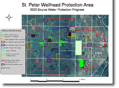
Peter Wellhead Protection Area
St. Peter Wellhead Protection
- Progress 2002
St. Peter Wellhead Protection -
Progress 2003
Website
2002
Watershed Heroes Conference, St. Peter
http://www.fb.org/programs/waterheroes/conf_6_02/

Project
Overview
Throughout
the 1980s, nitrate concentrations had been rising, slowly but steadily,
in two of the Jordan aquifer wells that supplied drinking to the City
of St. Peter, in south-central Minnesota. (The Jordan aquifer is contaminated
with nitrates at a level of 10 or more parts per million; the federal
drinking water standard is 10 ppm.)
As part of a 1993-1998 Clean Water Partnership project in east Nicollet
County, development of a wellhead protection plan was seen by many as
a logical step toward protection of the city’s water against future
degradation. Wellhead protection was seen as more than a mandated exercise
for the distant future; it was critical for providing safe, cost-efficient
water right then and for the next few years.
Because St. Peter was one of the first communities in the state to voluntarily
develop a wellhead protection plan, the program was able to secure a significant
amount of technical assistance from the Minnesota Department of Health
(MDH), the Minnesota Department of Agriculture, and the Minnesota Pollution
Control Agency.


Delineation
of the Drinking Water Supply Management Area
Combining
information about geologic formations in the area with well boring and
pumping-rate data from private wells of various depths, MDH created a
single-layer analytic element computer model. The model was able to define
groundwater flow boundaries in the area and determine the location of
the groundwater recharge area. Both flow boundary and recharge area are
important factors because the Jordan aquifer is cut by the Minnesota River
in this area and is subject to variable groundwater flow conditions based
on the amount of local precipitation. (For example, relatively flat hydraulic
gradients have been measured in years of relatively dry to normal precipitation,
whereas a ten-fold increase in gradients was noted during the flood season
of 1993.)
These precipitation-dependent variations in groundwater flow occur around
St. Peter because a sand terrace overlies the Jordan aquifer in this area.
Because no confining layer is present between the sand terrace and the
aquifer, recharge is relatively rapid. (Age-dating studies, using chloro-fluoro-carbon,
show only an average of 10 to 20 years in age for waters drawn from different
levels of the Jordan.)
Agricultural ditches west of the city flow eastward—draining clay-rich,
glacial-drift cropland and infiltrating the sand terrace. This infiltration
provides a significant source of nitrate-contaminated recharge to the
Jordan aquifer.
With that perspective, the city entered into the wellhead protection process
by delineating a Drinking Water Supply Management Area (DWSMA) that includes
the minor watershed west of the city, where crop production is the dominant
land use.
Protection
of the Drinking Water Supply Management Area
Since reduction
of nitrates is the primary focus of the final wellhead protection plan,
the Clean Water Partnership, from 1993 through 1998, educated farmers
in the DWSMA about nitrate-reduction, emphasizing the agricultural perspective.
City residents were educated from a lawn-care perspective. In the late
1990's, a coalition of local and state agencies, crop consultants, and
agri-business cooperatives began working to accelerate changes in the
fertilizer practices of the agricultural producers. Learn more about nitrogen
rate demonstrations.
| landowners | educators | site map |
Brown Nicollet Cottonwood Water Quality Board
322 South Minnesota Avenue | St. Peter, MN 56082 | Phone: 507-934-4140 | Fax: 507-934-8958