Sediment Sources
Where does the excess sediment come from?Sediment comes from many sources throughout the Minnesota River Basin including eroding from agricultural land, stream banks and stream beds, and from urban areas. Water quality monitoring results illustrate the strong influence that runoff exerts on the amount of sediment delivered to the Minnesota River. Agricultural Land
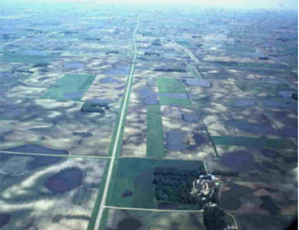
Although specific estimates of the total sediment contribution from agricultural land have not been made, based on the fact that agriculture comprises over 80 percent of the Basin’s land use, it is likely the dominant land use contributor of sediment to the Minnesota River. |
||||||
|
|
Ponding after a high intensity rain(intensity > infiltration) |
|||||
 |
Overland flow after a high intensity rain |
|||||
 |
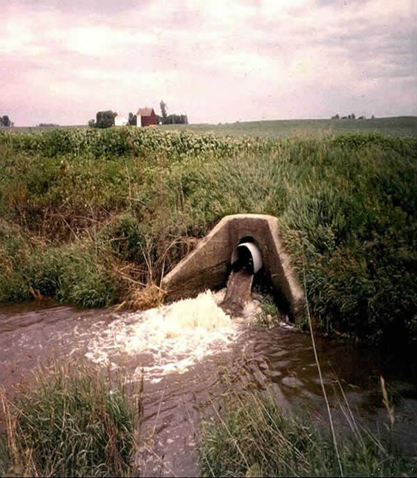
Ponding by tile intake Photo: After a heavy rain in the Watonwan watershed |
|||||
 |
||||||
| Open tile draining after a heavy rain | ||||||
Stream banks and stream bedThe banks and bed of streams and rivers are another source of sediment in the Minnesota River. The extent to which streambank erosion and streambed scouring account for the sediment load varies. At particular times and locations it can be significant. Recent studies of the Blue Earth River by the University of Minnesota estimated that 30 to 45 percent of suspended sediment originated from the bluffs and banks of this highly incised river, while highly erosive farm fields contributed about 40 percent of the sediment. The composition of sediment in the river is about 90 percent silt and clay, which can be transported long distances. Sand typically settles back to the streambed quickly. Sand comprises about 50 percent of bank and bed erosion. The degree to which stream bank and bed erosion is natural and unavoidable is not known. It is known that extensive artificial drainage has resulted in higher peak flows on some of the smaller tributary streams, which can lead to greater stream bank erosion. In addition, it is likely that a certain percentage of the sediments in the streambed and along the bank originated from upland sources. Thus, it is hard to clearly separate upland and near or in-stream sediment sources (Basin Plan, 2001). |
||||||
 |
Bank slumping and erosion Some places in the Basin have steep bluffs (see person for scale) Photo: Rush River Watershed |
|||||
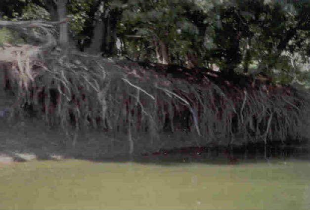 |
A destabilized Flood Plain Stream bank showing roots exposed by erosion Photo: Blue Earth River |
|||||
 |
Sediment accumulation along the banks of the river
|
|||||
Urban Sources
Urban and suburban land uses, while comprising only about 2 percent of the Basin, have been estimated to contribute about 30,000 tons of suspended sediment to the river per year. |
||||||
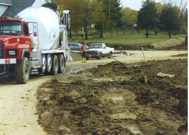 |
Sediment can flow from a variety of urban sources such as construction sites |
|||||
Downstream |
||||||
 |
Sediment flows into waterways | |||||
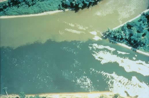 |
Sediment is carried downstream and is visible at the confluence of the Minnesota and Mississippi RIvers | |||||
|
|
||||||
|
This page was last updated 9/15/04 |
||||||