Minnesota Tillage Transect Survey Data Center
Minnesota Tillage Transect Survey Data Center
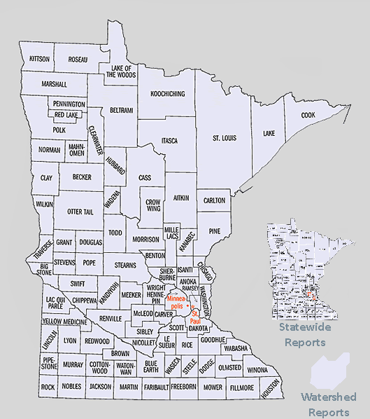
Click on County to access Reports or Scoll Down
Minnesota Statewide Tillage Transect Data
- Tillage Transect Survey 2007 Final Report - High Resolution (36 mb PDF)
- Tillage Transect Survey 2007 Final Report - Low Resolution (18 mb PDF)
- Tillage Transect Survey 8 Crop to 22 Crop Directory
- 2007 Crop Residue Data by County for all 67 Counties (zip file - 1.5 mb)
- Statewide GIS Crop Residue Point Data (Shapefile) for all 67 Counties (zip file - 3.3 mb)
- Statewide GIS Crop Residue Line Data (Shapefile) for all 67 Counties (zip file - 3.1 mb)
Resource Links for Crop Residue Management Surveys
- Conservation Technology Information Center (CTIC)
- Natural Resources Conservation Service (NRCS)
- Minnesota Natural Resources Conservation Service (NRCS)
- Minnesota Board of Water and Soil Resources
- No Till on the Plains
Minnesota Statewide Summary Reports
- 2007 Tillage Transect Survey - 8 Crop
- 2007 Tillage Transect Survey - 22 Crop
- 2006 Tillage Transect Survey - 8 Crop
- 2006 Tillage Transect Survey - 22 Crop
- 2004 Tillage Transect Survey - 8 Crop
- 2004 Tillage Transect Survey - 22 Crop
- 2002 Tillage Transect Survey - 8 Crop
- 2002 Tillage Transect Survey - 22 Crop
- 2000 Tillage Transect Survey - 8 Crop
- 2000 Tillage Transect Survey - 22 Crop
- 1998 Tillage Transect Survey - 8 Crop
- 1997 Tillage Transect Survey - 8 Crop
- 1996 Tillage Transect Survey - 8 Crop
- 1995 Tillage Transect Survey - 8 Crop
- 1994 Tillage Transect Survey - 8 Crop
- 1993 Tillage Transect Survey - 8 Crop
- 1992 Tillage Transect Survey - 8 Crop
- 1991 Tillage Transect Survey - 8 Crop
- 1990 Tillage Transect Survey - 8 Crop
- 1989 Tillage Transect Survey - 8 Crop
Aitkin |
- 2004 Tillage Transect Survey - 8 Crop
- 2004 Tillage Transect Survey - 22 Crop
- 2002 Tillage Transect Survey - 8 Crop
- 2002 Tillage Transect Survey - 22 Crop
- 2000 Tillage Transect Survey - 8 Crop
- 2000 Tillage Transect Survey - 22 Crop
- 1998 Tillage Transect Survey - 8 Crop
- 1997 Tillage Transect Survey - 8 Crop
- 1996 Tillage Transect Survey - 8 Crop
- 1995 Tillage Transect Survey - 8 Crop
- 1994 Tillage Transect Survey - 8 Crop
- 1993 Tillage Transect Survey - 8 Crop
- 1992 Tillage Transect Survey - 8 Crop
- 1991 Tillage Transect Survey - 8 Crop
- 1990 Tillage Transect Survey - 8 Crop
- 1989 Tillage Transect Survey - 8 Crop
Anoka
- 2004 Tillage Transect Survey - 8 Crop
- 2004 Tillage Transect Survey - 22 Crop
- 2002 Tillage Transect Survey - 8 Crop
- 2002 Tillage Transect Survey - 22 Crop
- 2000 Tillage Transect Survey - 8 Crop
- 2000 Tillage Transect Survey - 22 Crop
- 1998 Tillage Transect Survey - 8 Crop
- 1997 Tillage Transect Survey - 8 Crop
- 1996 Tillage Transect Survey - 8 Crop
- 1995 Tillage Transect Survey - 8 Crop
- 1994 Tillage Transect Survey - 8 Crop
- 1993 Tillage Transect Survey - 8 Crop
- 1992 Tillage Transect Survey - 8 Crop
- 1991 Tillage Transect Survey - 8 Crop
- 1990 Tillage Transect Survey - 8 Crop
- 1989 Tillage Transect Survey - 8 Crop
Becker |
- 2007 Tillage Transect Survey - 8 Crop
- 2007 Tillage Transect Survey - 22 Crop
- 2004 Tillage Transect Survey - 8 Crop
- 2004 Tillage Transect Survey - 22 Crop
- 2002 Tillage Transect Survey - 8 Crop
- 2002 Tillage Transect Survey - 22 Crop
- 2000 Tillage Transect Survey - 8 Crop
- 2000 Tillage Transect Survey - 22 Crop
- 1998 Tillage Transect Survey - 8 Crop
- 1997 Tillage Transect Survey - 8 Crop
- 1996 Tillage Transect Survey - 8 Crop
- 1995 Tillage Transect Survey - 8 Crop
- 1994 Tillage Transect Survey - 8 Crop
- 1993 Tillage Transect Survey - 8 Crop
- 1992 Tillage Transect Survey - 8 Crop
- 1991 Tillage Transect Survey - 8 Crop
- 1990 Tillage Transect Survey - 8 Crop
- 1989 Tillage Transect Survey - 8 Crop
Beltrami |
- 2004 Tillage Transect Survey - 8 Crop
- 2004 Tillage Transect Survey - 22 Crop
- 2002 Tillage Transect Survey - 8 Crop
- 2002 Tillage Transect Survey - 22 Crop
- 2000 Tillage Transect Survey - 8 Crop
- 2000 Tillage Transect Survey - 22 Crop
- 1998 Tillage Transect Survey - 8 Crop
- 1997 Tillage Transect Survey - 8 Crop
- 1996 Tillage Transect Survey - 8 Crop
- 1995 Tillage Transect Survey - 8 Crop
- 1994 Tillage Transect Survey - 8 Crop
- 1993 Tillage Transect Survey - 8 Crop
- 1992 Tillage Transect Survey - 8 Crop
- 1991 Tillage Transect Survey - 8 Crop
- 1990 Tillage Transect Survey - 8 Crop
- 1989 Tillage Transect Survey - 8 Crop
Benton |
- 2007 Tillage Transect Survey - 8 Crop
- 2007 Tillage Transect Survey - 22 Crop
- 2004 Tillage Transect Survey - 8 Crop
- 2004 Tillage Transect Survey - 22 Crop
- 2002 Tillage Transect Survey - 8 Crop
- 2002 Tillage Transect Survey - 22 Crop
- 2000 Tillage Transect Survey - 8 Crop
- 2000 Tillage Transect Survey - 22 Crop
- 1998 Tillage Transect Survey - 8 Crop
- 1997 Tillage Transect Survey - 8 Crop
- 1996 Tillage Transect Survey - 8 Crop
- 1995 Tillage Transect Survey - 8 Crop
- 1994 Tillage Transect Survey - 8 Crop
- 1993 Tillage Transect Survey - 8 Crop
- 1992 Tillage Transect Survey - 8 Crop
- 1991 Tillage Transect Survey - 8 Crop
- 1990 Tillage Transect Survey - 8 Crop
- 1989 Tillage Transect Survey - 8 Crop
Big Stone |
- 2007 Tillage Transect Survey - 8 Crop
- 2007 Tillage Transect Survey - 22 Crop
- 2006 Tillage Transect Survey - 8 Crop
- 2006 Tillage Transect Survey - 22 Crop
- 2004 Tillage Transect Survey - 8 Crop
- 2004 Tillage Transect Survey - 22 Crop
- 2002 Tillage Transect Survey - 8 Crop
- 2002 Tillage Transect Survey - 22 Crop
- 2000 Tillage Transect Survey - 8 Crop
- 2000 Tillage Transect Survey - 22 Crop
- 1998 Tillage Transect Survey - 8 Crop
- 1997 Tillage Transect Survey - 8 Crop
- 1996 Tillage Transect Survey - 8 Crop
- 1995 Tillage Transect Survey - 8 Crop
- 1994 Tillage Transect Survey - 8 Crop
- 1993 Tillage Transect Survey - 8 Crop
- 1992 Tillage Transect Survey - 8 Crop
- 1991 Tillage Transect Survey - 8 Crop
- 1990 Tillage Transect Survey - 8 Crop
- 1989 Tillage Transect Survey - 8 Crop
Blue Earth
- 2007 Tillage Transect Survey - 8 Crop
- 2007 Tillage Transect Survey - 22 Crop
- 2004 Tillage Transect Survey - 8 Crop
- 2004 Tillage Transect Survey - 22 Crop
- 2002 Tillage Transect Survey - 8 Crop
- 2002 Tillage Transect Survey - 22 Crop
- 2000 Tillage Transect Survey - 8 Crop
- 2000 Tillage Transect Survey - 22 Crop
- 1998 Tillage Transect Survey - 8 Crop
- 1997 Tillage Transect Survey - 8 Crop
- 1996 Tillage Transect Survey - 8 Crop
- 1995 Tillage Transect Survey - 8 Crop
- 1994 Tillage Transect Survey - 8 Crop
- 1993 Tillage Transect Survey - 8 Crop
- 1992 Tillage Transect Survey - 8 Crop
- 1991 Tillage Transect Survey - 8 Crop
- 1990 Tillage Transect Survey - 8 Crop
- 1989 Tillage Transect Survey - 8 Crop
Brown |
- 2007 Tillage Transect Survey - 8 Crop
- 2007 Tillage Transect Survey - 22 Crop
- 2006 Tillage Transect Survey - 8 Crop
- 2006 Tillage Transect Survey - 22 Crop
- 2004 Tillage Transect Survey - 8 Crop
- 2004 Tillage Transect Survey - 22 Crop
- 2002 Tillage Transect Survey - 8 Crop
- 2002 Tillage Transect Survey - 22 Crop
- 2000 Tillage Transect Survey - 8 Crop
- 2000 Tillage Transect Survey - 22 Crop
- 1998 Tillage Transect Survey - 8 Crop
- 1997 Tillage Transect Survey - 8 Crop
- 1996 Tillage Transect Survey - 8 Crop
- 1995 Tillage Transect Survey - 8 Crop
- 1994 Tillage Transect Survey - 8 Crop
- 1993 Tillage Transect Survey - 8 Crop
- 1992 Tillage Transect Survey - 8 Crop
- 1991 Tillage Transect Survey - 8 Crop
- 1990 Tillage Transect Survey - 8 Crop
- 1989 Tillage Transect Survey - 8 Crop
Carlton |
- 2004 Tillage Transect Survey - 8 Crop
- 2004 Tillage Transect Survey - 22 Crop
- 2002 Tillage Transect Survey - 8 Crop
- 2002 Tillage Transect Survey - 22 Crop
- 2000 Tillage Transect Survey - 8 Crop
- 2000 Tillage Transect Survey - 22 Crop
- 1998 Tillage Transect Survey - 8 Crop
- 1997 Tillage Transect Survey - 8 Crop
- 1996 Tillage Transect Survey - 8 Crop
- 1995 Tillage Transect Survey - 8 Crop
- 1994 Tillage Transect Survey - 8 Crop
- 1993 Tillage Transect Survey - 8 Crop
- 1992 Tillage Transect Survey - 8 Crop
- 1991 Tillage Transect Survey - 8 Crop
- 1990 Tillage Transect Survey - 8 Crop
- 1989 Tillage Transect Survey - 8 Crop
Carver
- 2007 Tillage Transect Survey - 8 Crop
- 2007 Tillage Transect Survey - 22 Crop
- 2004 Tillage Transect Survey - 8 Crop
- 2004 Tillage Transect Survey - 22 Crop
- 2002 Tillage Transect Survey - 8 Crop
- 2002 Tillage Transect Survey - 22 Crop
- 2000 Tillage Transect Survey - 8 Crop
- 2000 Tillage Transect Survey - 22 Crop
- 1998 Tillage Transect Survey - 8 Crop
- 1997 Tillage Transect Survey - 8 Crop
- 1996 Tillage Transect Survey - 8 Crop
- 1995 Tillage Transect Survey - 8 Crop
- 1994 Tillage Transect Survey - 8 Crop
- 1993 Tillage Transect Survey - 8 Crop
- 1992 Tillage Transect Survey - 8 Crop
- 1991 Tillage Transect Survey - 8 Crop
- 1990 Tillage Transect Survey - 8 Crop
- 1989 Tillage Transect Survey - 8 Crop
Cass |
- 2004 Tillage Transect Survey - 8 Crop
- 2004 Tillage Transect Survey - 22 Crop
- 2002 Tillage Transect Survey - 8 Crop
- 2002 Tillage Transect Survey - 22 Crop
- 2000 Tillage Transect Survey - 8 Crop
- 2000 Tillage Transect Survey - 22 Crop
- 1998 Tillage Transect Survey - 8 Crop
- 1997 Tillage Transect Survey - 8 Crop
- 1996 Tillage Transect Survey - 8 Crop
- 1995 Tillage Transect Survey - 8 Crop
- 1994 Tillage Transect Survey - 8 Crop
- 1993 Tillage Transect Survey - 8 Crop
- 1992 Tillage Transect Survey - 8 Crop
- 1991 Tillage Transect Survey - 8 Crop
- 1990 Tillage Transect Survey - 8 Crop
- 1989 Tillage Transect Survey - 8 Crop
Chippewa |
- 2007 Tillage Transect Survey - 8 Crop
- 2007 Tillage Transect Survey - 22 Crop
- 2006 Tillage Transect Survey - 8 Crop
- 2006 Tillage Transect Survey - 22 Crop
- 2004 Tillage Transect Survey - 8 Crop
- 2004 Tillage Transect Survey - 22 Crop
- 2002 Tillage Transect Survey - 8 Crop
- 2002 Tillage Transect Survey - 22 Crop
- 2000 Tillage Transect Survey - 8 Crop
- 2000 Tillage Transect Survey - 22 Crop
- 1998 Tillage Transect Survey - 8 Crop
- 1997 Tillage Transect Survey - 8 Crop
- 1996 Tillage Transect Survey - 8 Crop
- 1995 Tillage Transect Survey - 8 Crop
- 1994 Tillage Transect Survey - 8 Crop
- 1993 Tillage Transect Survey - 8 Crop
- 1992 Tillage Transect Survey - 8 Crop
- 1991 Tillage Transect Survey - 8 Crop
- 1990 Tillage Transect Survey - 8 Crop
- 1989 Tillage Transect Survey - 8 Crop
Chisago
- 2007 Tillage Transect Survey - 8 Crop
- 2007 Tillage Transect Survey - 22 Crop
- 2004 Tillage Transect Survey - 8 Crop
- 2004 Tillage Transect Survey - 22 Crop
- 2002 Tillage Transect Survey - 8 Crop
- 2002 Tillage Transect Survey - 22 Crop
- 2000 Tillage Transect Survey - 8 Crop
- 2000 Tillage Transect Survey - 22 Crop
- 1998 Tillage Transect Survey - 8 Crop
- 1997 Tillage Transect Survey - 8 Crop
- 1996 Tillage Transect Survey - 8 Crop
- 1995 Tillage Transect Survey - 8 Crop
- 1994 Tillage Transect Survey - 8 Crop
- 1993 Tillage Transect Survey - 8 Crop
- 1992 Tillage Transect Survey - 8 Crop
- 1991 Tillage Transect Survey - 8 Crop
- 1990 Tillage Transect Survey - 8 Crop
- 1989 Tillage Transect Survey - 8 Crop
Clay |
- 2007 Tillage Transect Survey - 8 Crop
- 2007 Tillage Transect Survey - 22 Crop
- 2004 Tillage Transect Survey - 8 Crop
- 2004 Tillage Transect Survey - 22 Crop
- 2002 Tillage Transect Survey - 8 Crop
- 2002 Tillage Transect Survey - 22 Crop
- 2000 Tillage Transect Survey - 8 Crop
- 2000 Tillage Transect Survey - 22 Crop
- 1998 Tillage Transect Survey - 8 Crop
- 1997 Tillage Transect Survey - 8 Crop
- 1996 Tillage Transect Survey - 8 Crop
- 1995 Tillage Transect Survey - 8 Crop
- 1994 Tillage Transect Survey - 8 Crop
- 1993 Tillage Transect Survey - 8 Crop
- 1992 Tillage Transect Survey - 8 Crop
- 1991 Tillage Transect Survey - 8 Crop
- 1990 Tillage Transect Survey - 8 Crop
- 1989 Tillage Transect Survey - 8 Crop
Clearwater |
- 2004 Tillage Transect Survey - 8 Crop
- 2004 Tillage Transect Survey - 22 Crop
- 2002 Tillage Transect Survey - 8 Crop
- 2002 Tillage Transect Survey - 22 Crop
- 2000 Tillage Transect Survey - 8 Crop
- 2000 Tillage Transect Survey - 22 Crop
- 1998 Tillage Transect Survey - 8 Crop
- 1997 Tillage Transect Survey - 8 Crop
- 1996 Tillage Transect Survey - 8 Crop
- 1995 Tillage Transect Survey - 8 Crop
- 1994 Tillage Transect Survey - 8 Crop
- 1993 Tillage Transect Survey - 8 Crop
- 1992 Tillage Transect Survey - 8 Crop
- 1991 Tillage Transect Survey - 8 Crop
- 1990 Tillage Transect Survey - 8 Crop
- 1989 Tillage Transect Survey - 8 Crop
Cook |
- 2004 Tillage Transect Survey - 8 Crop
- 2004 Tillage Transect Survey - 22 Crop
- 2002 Tillage Transect Survey - 8 Crop
- 2002 Tillage Transect Survey - 22 Crop
- 2000 Tillage Transect Survey - 8 Crop
- 2000 Tillage Transect Survey - 22 Crop
- 1998 Tillage Transect Survey - 8 Crop
- 1997 Tillage Transect Survey - 8 Crop
- 1996 Tillage Transect Survey - 8 Crop
- 1995 Tillage Transect Survey - 8 Crop
- 1994 Tillage Transect Survey - 8 Crop
- 1993 Tillage Transect Survey - 8 Crop
- 1992 Tillage Transect Survey - 8 Crop
- 1991 Tillage Transect Survey - 8 Crop
- 1990 Tillage Transect Survey - 8 Crop
- 1989 Tillage Transect Survey - 8 Crop
Cottonwood |
- 2007 Tillage Transect Survey - 8 Crop
- 2007 Tillage Transect Survey - 22 Crop
- 2004 Tillage Transect Survey - 8 Crop
- 2004 Tillage Transect Survey - 22 Crop
- 2002 Tillage Transect Survey - 8 Crop
- 2002 Tillage Transect Survey - 22 Crop
- 2000 Tillage Transect Survey - 8 Crop
- 2000 Tillage Transect Survey - 22 Crop
- 1998 Tillage Transect Survey - 8 Crop
- 1997 Tillage Transect Survey - 8 Crop
- 1996 Tillage Transect Survey - 8 Crop
- 1995 Tillage Transect Survey - 8 Crop
- 1994 Tillage Transect Survey - 8 Crop
- 1993 Tillage Transect Survey - 8 Crop
- 1992 Tillage Transect Survey - 8 Crop
- 1991 Tillage Transect Survey - 8 Crop
- 1990 Tillage Transect Survey - 8 Crop
- 1989 Tillage Transect Survey - 8 Crop
Crow Wing
- 2004 Tillage Transect Survey - 8 Crop
- 2004 Tillage Transect Survey - 22 Crop
- 2002 Tillage Transect Survey - 8 Crop
- 2002 Tillage Transect Survey - 22 Crop
- 2000 Tillage Transect Survey - 8 Crop
- 2000 Tillage Transect Survey - 22 Crop
- 1998 Tillage Transect Survey - 8 Crop
- 1997 Tillage Transect Survey - 8 Crop
- 1996 Tillage Transect Survey - 8 Crop
- 1995 Tillage Transect Survey - 8 Crop
- 1994 Tillage Transect Survey - 8 Crop
- 1993 Tillage Transect Survey - 8 Crop
- 1992 Tillage Transect Survey - 8 Crop
- 1991 Tillage Transect Survey - 8 Crop
- 1990 Tillage Transect Survey - 8 Crop
- 1989 Tillage Transect Survey - 8 Crop
Dakota
- 2007 Tillage Transect Survey - 8 Crop
- 2007 Tillage Transect Survey - 22 Crop
- 2004 Tillage Transect Survey - 8 Crop
- 2004 Tillage Transect Survey - 22 Crop
- 2002 Tillage Transect Survey - 8 Crop
- 2002 Tillage Transect Survey - 22 Crop
- 2000 Tillage Transect Survey - 8 Crop
- 2000 Tillage Transect Survey - 22 Crop
- 1998 Tillage Transect Survey - 8 Crop
- 1997 Tillage Transect Survey - 8 Crop
- 1996 Tillage Transect Survey - 8 Crop
- 1995 Tillage Transect Survey - 8 Crop
- 1994 Tillage Transect Survey - 8 Crop
- 1993 Tillage Transect Survey - 8 Crop
- 1992 Tillage Transect Survey - 8 Crop
- 1991 Tillage Transect Survey - 8 Crop
- 1990 Tillage Transect Survey - 8 Crop
- 1989 Tillage Transect Survey - 8 Crop
Dodge |
- 2007 Tillage Transect Survey - 8 Crop
- 2007 Tillage Transect Survey - 22 Crop
- 2006 Tillage Transect Survey - 8 Crop
- 2006 Tillage Transect Survey - 22 Crop
- 2004 Tillage Transect Survey - 8 Crop
- 2004 Tillage Transect Survey - 22 Crop
- 2002 Tillage Transect Survey - 8 Crop
- 2002 Tillage Transect Survey - 22 Crop
- 2000 Tillage Transect Survey - 8 Crop
- 2000 Tillage Transect Survey - 22 Crop
- 1998 Tillage Transect Survey - 8 Crop
- 1997 Tillage Transect Survey - 8 Crop
- 1996 Tillage Transect Survey - 8 Crop
- 1995 Tillage Transect Survey - 8 Crop
- 1994 Tillage Transect Survey - 8 Crop
- 1993 Tillage Transect Survey - 8 Crop
- 1992 Tillage Transect Survey - 8 Crop
- 1991 Tillage Transect Survey - 8 Crop
- 1990 Tillage Transect Survey - 8 Crop
- 1989 Tillage Transect Survey - 8 Crop
Douglas
- 2007 Tillage Transect Survey - 8 Crop
- 2007 Tillage Transect Survey - 22 Crop
- 2004 Tillage Transect Survey - 8 Crop
- 2004 Tillage Transect Survey - 22 Crop
- 2002 Tillage Transect Survey - 8 Crop
- 2002 Tillage Transect Survey - 22 Crop
- 2000 Tillage Transect Survey - 8 Crop
- 2000 Tillage Transect Survey - 22 Crop
- 1998 Tillage Transect Survey - 8 Crop
- 1997 Tillage Transect Survey - 8 Crop
- 1996 Tillage Transect Survey - 8 Crop
- 1995 Tillage Transect Survey - 8 Crop
- 1994 Tillage Transect Survey - 8 Crop
- 1993 Tillage Transect Survey - 8 Crop
- 1992 Tillage Transect Survey - 8 Crop
- 1991 Tillage Transect Survey - 8 Crop
- 1990 Tillage Transect Survey - 8 Crop
- 1989 Tillage Transect Survey - 8 Crop
Faribault |
- 2007 Tillage Transect Survey - 8 Crop
- 2007 Tillage Transect Survey - 22 Crop
- 2004 Tillage Transect Survey - 8 Crop
- 2004 Tillage Transect Survey - 22 Crop
- 2002 Tillage Transect Survey - 8 Crop
- 2002 Tillage Transect Survey - 22 Crop
- 2000 Tillage Transect Survey - 8 Crop
- 2000 Tillage Transect Survey - 22 Crop
- 1998 Tillage Transect Survey - 8 Crop
- 1997 Tillage Transect Survey - 8 Crop
- 1996 Tillage Transect Survey - 8 Crop
- 1995 Tillage Transect Survey - 8 Crop
- 1994 Tillage Transect Survey - 8 Crop
- 1993 Tillage Transect Survey - 8 Crop
- 1992 Tillage Transect Survey - 8 Crop
- 1991 Tillage Transect Survey - 8 Crop
- 1990 Tillage Transect Survey - 8 Crop
- 1989 Tillage Transect Survey - 8 Crop
Fillmore |
- 2007 Tillage Transect Survey - 8 Crop
- 2007 Tillage Transect Survey - 22 Crop
- 2004 Tillage Transect Survey - 8 Crop
- 2004 Tillage Transect Survey - 22 Crop
- 2002 Tillage Transect Survey - 8 Crop
- 2002 Tillage Transect Survey - 22 Crop
- 2000 Tillage Transect Survey - 8 Crop
- 2000 Tillage Transect Survey - 22 Crop
- 1998 Tillage Transect Survey - 8 Crop
- 1997 Tillage Transect Survey - 8 Crop
- 1996 Tillage Transect Survey - 8 Crop
- 1995 Tillage Transect Survey - 8 Crop
- 1994 Tillage Transect Survey - 8 Crop
- 1993 Tillage Transect Survey - 8 Crop
- 1992 Tillage Transect Survey - 8 Crop
- 1991 Tillage Transect Survey - 8 Crop
- 1990 Tillage Transect Survey - 8 Crop
- 1989 Tillage Transect Survey - 8 Crop
(top of page)
Freeborn
- 2007 Tillage Transect Survey - 8 Crop
- 2007 Tillage Transect Survey - 22 Crop
- 2004 Tillage Transect Survey - 8 Crop
- 2004 Tillage Transect Survey - 22 Crop
- 2002 Tillage Transect Survey - 8 Crop
- 2002 Tillage Transect Survey - 22 Crop
- 2000 Tillage Transect Survey - 8 Crop
- 2000 Tillage Transect Survey - 22 Crop
- 1998 Tillage Transect Survey - 8 Crop
- 1997 Tillage Transect Survey - 8 Crop
- 1996 Tillage Transect Survey - 8 Crop
- 1995 Tillage Transect Survey - 8 Crop
- 1994 Tillage Transect Survey - 8 Crop
- 1993 Tillage Transect Survey - 8 Crop
- 1992 Tillage Transect Survey - 8 Crop
- 1991 Tillage Transect Survey - 8 Crop
- 1990 Tillage Transect Survey - 8 Crop
- 1989 Tillage Transect Survey - 8 Crop
Goodhue
- 2007 Tillage Transect Survey - 8 Crop
- 2007 Tillage Transect Survey - 22 Crop
- 2006 Tillage Transect Survey - 8 Crop
- 2006 Tillage Transect Survey - 22 Crop
- 2004 Tillage Transect Survey - 8 Crop
- 2004 Tillage Transect Survey - 22 Crop
- 2002 Tillage Transect Survey - 8 Crop
- 2002 Tillage Transect Survey - 22 Crop
- 2000 Tillage Transect Survey - 8 Crop
- 2000 Tillage Transect Survey - 22 Crop
- 1998 Tillage Transect Survey - 8 Crop
- 1997 Tillage Transect Survey - 8 Crop
- 1996 Tillage Transect Survey - 8 Crop
- 1995 Tillage Transect Survey - 8 Crop
- 1994 Tillage Transect Survey - 8 Crop
- 1993 Tillage Transect Survey - 8 Crop
- 1992 Tillage Transect Survey - 8 Crop
- 1991 Tillage Transect Survey - 8 Crop
- 1990 Tillage Transect Survey - 8 Crop
- 1989 Tillage Transect Survey - 8 Crop
Grant |
- 2007 Tillage Transect Survey - 8 Crop
- 2007 Tillage Transect Survey - 22 Crop
- 2004 Tillage Transect Survey - 8 Crop
- 2004 Tillage Transect Survey - 22 Crop
- 2002 Tillage Transect Survey - 8 Crop
- 2002 Tillage Transect Survey - 22 Crop
- 2000 Tillage Transect Survey - 8 Crop
- 2000 Tillage Transect Survey - 22 Crop
- 1998 Tillage Transect Survey - 8 Crop
- 1997 Tillage Transect Survey - 8 Crop
- 1996 Tillage Transect Survey - 8 Crop
- 1995 Tillage Transect Survey - 8 Crop
- 1994 Tillage Transect Survey - 8 Crop
- 1993 Tillage Transect Survey - 8 Crop
- 1992 Tillage Transect Survey - 8 Crop
- 1991 Tillage Transect Survey - 8 Crop
- 1990 Tillage Transect Survey - 8 Crop
- 1989 Tillage Transect Survey - 8 Crop
Hennepin
- 2004 Tillage Transect Survey - 8 Crop
- 2004 Tillage Transect Survey - 22 Crop
- 2002 Tillage Transect Survey - 8 Crop
- 2002 Tillage Transect Survey - 22 Crop
- 2000 Tillage Transect Survey - 8 Crop
- 2000 Tillage Transect Survey - 22 Crop
- 1998 Tillage Transect Survey - 8 Crop
- 1997 Tillage Transect Survey - 8 Crop
- 1996 Tillage Transect Survey - 8 Crop
- 1995 Tillage Transect Survey - 8 Crop
- 1994 Tillage Transect Survey - 8 Crop
- 1993 Tillage Transect Survey - 8 Crop
- 1992 Tillage Transect Survey - 8 Crop
- 1991 Tillage Transect Survey - 8 Crop
- 1990 Tillage Transect Survey - 8 Crop
- 1989 Tillage Transect Survey - 8 Crop
Houston |
- 2007 Tillage Transect Survey - 8 Crop
- 2007 Tillage Transect Survey - 22 Crop
- 2004 Tillage Transect Survey - 8 Crop
- 2004 Tillage Transect Survey - 22 Crop
- 2002 Tillage Transect Survey - 8 Crop
- 2002 Tillage Transect Survey - 22 Crop
- 2000 Tillage Transect Survey - 8 Crop
- 2000 Tillage Transect Survey - 22 Crop
- 1998 Tillage Transect Survey - 8 Crop
- 1997 Tillage Transect Survey - 8 Crop
- 1996 Tillage Transect Survey - 8 Crop
- 1995 Tillage Transect Survey - 8 Crop
- 1994 Tillage Transect Survey - 8 Crop
- 1993 Tillage Transect Survey - 8 Crop
- 1992 Tillage Transect Survey - 8 Crop
- 1991 Tillage Transect Survey - 8 Crop
- 1990 Tillage Transect Survey - 8 Crop
- 1989 Tillage Transect Survey - 8 Crop
Hubbard |
- 2004 Tillage Transect Survey - 8 Crop
- 2004 Tillage Transect Survey - 22 Crop
- 2002 Tillage Transect Survey - 8 Crop
- 2002 Tillage Transect Survey - 22 Crop
- 2000 Tillage Transect Survey - 8 Crop
- 2000 Tillage Transect Survey - 22 Crop
- 1998 Tillage Transect Survey - 8 Crop
- 1997 Tillage Transect Survey - 8 Crop
- 1996 Tillage Transect Survey - 8 Crop
- 1995 Tillage Transect Survey - 8 Crop
- 1994 Tillage Transect Survey - 8 Crop
- 1993 Tillage Transect Survey - 8 Crop
- 1992 Tillage Transect Survey - 8 Crop
- 1991 Tillage Transect Survey - 8 Crop
- 1990 Tillage Transect Survey - 8 Crop
- 1989 Tillage Transect Survey - 8 Crop
Isanti |
- 2007 Tillage Transect Survey - 8 Crop
- 2007 Tillage Transect Survey - 22 Crop
- 2004 Tillage Transect Survey - 8 Crop
- 2004 Tillage Transect Survey - 22 Crop
- 2002 Tillage Transect Survey - 8 Crop
- 2002 Tillage Transect Survey - 22 Crop
- 2000 Tillage Transect Survey - 8 Crop
- 2000 Tillage Transect Survey - 22 Crop
- 1998 Tillage Transect Survey - 8 Crop
- 1997 Tillage Transect Survey - 8 Crop
- 1996 Tillage Transect Survey - 8 Crop
- 1995 Tillage Transect Survey - 8 Crop
- 1994 Tillage Transect Survey - 8 Crop
- 1993 Tillage Transect Survey - 8 Crop
- 1992 Tillage Transect Survey - 8 Crop
- 1991 Tillage Transect Survey - 8 Crop
- 1990 Tillage Transect Survey - 8 Crop
- 1989 Tillage Transect Survey - 8 Crop
Itasca |
- 2004 Tillage Transect Survey - 8 Crop
- 2004 Tillage Transect Survey - 22 Crop
- 2002 Tillage Transect Survey - 8 Crop
- 2002 Tillage Transect Survey - 22 Crop
- 2000 Tillage Transect Survey - 8 Crop
- 2000 Tillage Transect Survey - 22 Crop
- 1998 Tillage Transect Survey - 8 Crop
- 1997 Tillage Transect Survey - 8 Crop
- 1996 Tillage Transect Survey - 8 Crop
- 1995 Tillage Transect Survey - 8 Crop
- 1994 Tillage Transect Survey - 8 Crop
- 1993 Tillage Transect Survey - 8 Crop
- 1992 Tillage Transect Survey - 8 Crop
- 1991 Tillage Transect Survey - 8 Crop
- 1990 Tillage Transect Survey - 8 Crop
- 1989 Tillage Transect Survey - 8 Crop
Jackson |
- 2007 Tillage Transect Survey - 8 Crop
- 2007 Tillage Transect Survey - 22 Crop
- 2004 Tillage Transect Survey - 8 Crop
- 2004 Tillage Transect Survey - 22 Crop
- 2002 Tillage Transect Survey - 8 Crop
- 2002 Tillage Transect Survey - 22 Crop
- 2000 Tillage Transect Survey - 8 Crop
- 2000 Tillage Transect Survey - 22 Crop
- 1998 Tillage Transect Survey - 8 Crop
- 1997 Tillage Transect Survey - 8 Crop
- 1996 Tillage Transect Survey - 8 Crop
- 1995 Tillage Transect Survey - 8 Crop
- 1994 Tillage Transect Survey - 8 Crop
- 1993 Tillage Transect Survey - 8 Crop
- 1992 Tillage Transect Survey - 8 Crop
- 1991 Tillage Transect Survey - 8 Crop
- 1990 Tillage Transect Survey - 8 Crop
- 1989 Tillage Transect Survey - 8 Crop
Kanabec |
- 2004 Tillage Transect Survey - 8 Crop
- 2004 Tillage Transect Survey - 22 Crop
- 2002 Tillage Transect Survey - 8 Crop
- 2002 Tillage Transect Survey - 22 Crop
- 2000 Tillage Transect Survey - 8 Crop
- 2000 Tillage Transect Survey - 22 Crop
- 1998 Tillage Transect Survey - 8 Crop
- 1997 Tillage Transect Survey - 8 Crop
- 1996 Tillage Transect Survey - 8 Crop
- 1995 Tillage Transect Survey - 8 Crop
- 1994 Tillage Transect Survey - 8 Crop
- 1993 Tillage Transect Survey - 8 Crop
- 1992 Tillage Transect Survey - 8 Crop
- 1991 Tillage Transect Survey - 8 Crop
- 1990 Tillage Transect Survey - 8 Crop
- 1989 Tillage Transect Survey - 8 Crop
Kandiyohi
- 2007 Tillage Transect Survey - 8 Crop
- 2007 Tillage Transect Survey - 22 Crop
- 2004 Tillage Transect Survey - 8 Crop
- 2004 Tillage Transect Survey - 22 Crop
- 2002 Tillage Transect Survey - 8 Crop
- 2002 Tillage Transect Survey - 22 Crop
- 2000 Tillage Transect Survey - 8 Crop
- 2000 Tillage Transect Survey - 22 Crop
- 1998 Tillage Transect Survey - 8 Crop
- 1997 Tillage Transect Survey - 8 Crop
- 1996 Tillage Transect Survey - 8 Crop
- 1995 Tillage Transect Survey - 8 Crop
- 1994 Tillage Transect Survey - 8 Crop
- 1993 Tillage Transect Survey - 8 Crop
- 1992 Tillage Transect Survey - 8 Crop
- 1991 Tillage Transect Survey - 8 Crop
- 1990 Tillage Transect Survey - 8 Crop
- 1989 Tillage Transect Survey - 8 Crop
Kittson |
- 2007 Tillage Transect Survey - 8 Crop
- 2007 Tillage Transect Survey - 22 Crop
- 2004 Tillage Transect Survey - 8 Crop
- 2004 Tillage Transect Survey - 22 Crop
- 2002 Tillage Transect Survey - 8 Crop
- 2002 Tillage Transect Survey - 22 Crop
- 2000 Tillage Transect Survey - 8 Crop
- 2000 Tillage Transect Survey - 22 Crop
- 1998 Tillage Transect Survey - 8 Crop
- 1997 Tillage Transect Survey - 8 Crop
- 1996 Tillage Transect Survey - 8 Crop
- 1995 Tillage Transect Survey - 8 Crop
- 1994 Tillage Transect Survey - 8 Crop
- 1993 Tillage Transect Survey - 8 Crop
- 1992 Tillage Transect Survey - 8 Crop
- 1991 Tillage Transect Survey - 8 Crop
- 1990 Tillage Transect Survey - 8 Crop
- 1989 Tillage Transect Survey - 8 Crop
Koochiching |
- 2004 Tillage Transect Survey - 8 Crop
- 2004 Tillage Transect Survey - 22 Crop
- 2002 Tillage Transect Survey - 8 Crop
- 2002 Tillage Transect Survey - 22 Crop
- 2000 Tillage Transect Survey - 8 Crop
- 2000 Tillage Transect Survey - 22 Crop
- 1998 Tillage Transect Survey - 8 Crop
- 1997 Tillage Transect Survey - 8 Crop
- 1996 Tillage Transect Survey - 8 Crop
- 1995 Tillage Transect Survey - 8 Crop
- 1994 Tillage Transect Survey - 8 Crop
- 1993 Tillage Transect Survey - 8 Crop
- 1992 Tillage Transect Survey - 8 Crop
- 1991 Tillage Transect Survey - 8 Crop
- 1990 Tillage Transect Survey - 8 Crop
- 1989 Tillage Transect Survey - 8 Crop
Lac Qui Parle |
- 2007 Tillage Transect Survey - 8 Crop
- 2007 Tillage Transect Survey - 22 Crop
- 2006 Tillage Transect Survey - 8 Crop
- 2006 Tillage Transect Survey - 22 Crop
- 2004 Tillage Transect Survey - 8 Crop
- 2004 Tillage Transect Survey - 22 Crop
- 2002 Tillage Transect Survey - 8 Crop
- 2002 Tillage Transect Survey - 22 Crop
- 2000 Tillage Transect Survey - 8 Crop
- 2000 Tillage Transect Survey - 22 Crop
- 1998 Tillage Transect Survey - 8 Crop
- 1997 Tillage Transect Survey - 8 Crop
- 1996 Tillage Transect Survey - 8 Crop
- 1995 Tillage Transect Survey - 8 Crop
- 1994 Tillage Transect Survey - 8 Crop
- 1993 Tillage Transect Survey - 8 Crop
- 1992 Tillage Transect Survey - 8 Crop
- 1991 Tillage Transect Survey - 8 Crop
- 1990 Tillage Transect Survey - 8 Crop
- 1989 Tillage Transect Survey - 8 Crop
Lake |
- 2004 Tillage Transect Survey - 8 Crop
- 2004 Tillage Transect Survey - 22 Crop
- 2002 Tillage Transect Survey - 8 Crop
- 2002 Tillage Transect Survey - 22 Crop
- 2000 Tillage Transect Survey - 8 Crop
- 2000 Tillage Transect Survey - 22 Crop
- 1998 Tillage Transect Survey - 8 Crop
- 1997 Tillage Transect Survey - 8 Crop
- 1996 Tillage Transect Survey - 8 Crop
- 1995 Tillage Transect Survey - 8 Crop
- 1994 Tillage Transect Survey - 8 Crop
- 1993 Tillage Transect Survey - 8 Crop
- 1992 Tillage Transect Survey - 8 Crop
- 1991 Tillage Transect Survey - 8 Crop
- 1990 Tillage Transect Survey - 8 Crop
- 1989 Tillage Transect Survey - 8 Crop
Lake of the Woods |
- 2004 Tillage Transect Survey - 8 Crop
- 2004 Tillage Transect Survey - 22 Crop
- 2002 Tillage Transect Survey - 8 Crop
- 2002 Tillage Transect Survey - 22 Crop
- 2000 Tillage Transect Survey - 8 Crop
- 2000 Tillage Transect Survey - 22 Crop
- 1998 Tillage Transect Survey - 8 Crop
- 1997 Tillage Transect Survey - 8 Crop
- 1996 Tillage Transect Survey - 8 Crop
- 1995 Tillage Transect Survey - 8 Crop
- 1994 Tillage Transect Survey - 8 Crop
- 1993 Tillage Transect Survey - 8 Crop
- 1992 Tillage Transect Survey - 8 Crop
- 1991 Tillage Transect Survey - 8 Crop
- 1990 Tillage Transect Survey - 8 Crop
- 1989 Tillage Transect Survey - 8 Crop
Le Sueur |
- 2007 Tillage Transect Survey - 8 Crop
- 2007 Tillage Transect Survey - 22 Crop
- 2004 Tillage Transect Survey - 8 Crop
- 2004 Tillage Transect Survey - 22 Crop
- 2002 Tillage Transect Survey - 8 Crop
- 2002 Tillage Transect Survey - 22 Crop
- 2000 Tillage Transect Survey - 8 Crop
- 2000 Tillage Transect Survey - 22 Crop
- 1998 Tillage Transect Survey - 8 Crop
- 1997 Tillage Transect Survey - 8 Crop
- 1996 Tillage Transect Survey - 8 Crop
- 1995 Tillage Transect Survey - 8 Crop
- 1994 Tillage Transect Survey - 8 Crop
- 1993 Tillage Transect Survey - 8 Crop
- 1992 Tillage Transect Survey - 8 Crop
- 1991 Tillage Transect Survey - 8 Crop
- 1990 Tillage Transect Survey - 8 Crop
- 1989 Tillage Transect Survey - 8 Crop
Lincoln |
- 2007 Tillage Transect Survey - 8 Crop
- 2007 Tillage Transect Survey - 22 Crop
- 2006 Tillage Transect Survey - 8 Crop
- 2006 Tillage Transect Survey - 22 Crop
- 2004 Tillage Transect Survey - 8 Crop
- 2004 Tillage Transect Survey - 22 Crop
- 2002 Tillage Transect Survey - 8 Crop
- 2002 Tillage Transect Survey - 22 Crop
- 2000 Tillage Transect Survey - 8 Crop
- 2000 Tillage Transect Survey - 22 Crop
- 1998 Tillage Transect Survey - 8 Crop
- 1997 Tillage Transect Survey - 8 Crop
- 1996 Tillage Transect Survey - 8 Crop
- 1995 Tillage Transect Survey - 8 Crop
- 1994 Tillage Transect Survey - 8 Crop
- 1993 Tillage Transect Survey - 8 Crop
- 1992 Tillage Transect Survey - 8 Crop
- 1991 Tillage Transect Survey - 8 Crop
- 1990 Tillage Transect Survey - 8 Crop
- 1989 Tillage Transect Survey - 8 Crop
Lyon |
- 2007 Tillage Transect Survey - 8 Crop
- 2007 Tillage Transect Survey - 22 Crop
- 2004 Tillage Transect Survey - 8 Crop
- 2004 Tillage Transect Survey - 22 Crop
- 2002 Tillage Transect Survey - 8 Crop
- 2002 Tillage Transect Survey - 22 Crop
- 2000 Tillage Transect Survey - 8 Crop
- 2000 Tillage Transect Survey - 22 Crop
- 1998 Tillage Transect Survey - 8 Crop
- 1997 Tillage Transect Survey - 8 Crop
- 1996 Tillage Transect Survey - 8 Crop
- 1995 Tillage Transect Survey - 8 Crop
- 1994 Tillage Transect Survey - 8 Crop
- 1993 Tillage Transect Survey - 8 Crop
- 1992 Tillage Transect Survey - 8 Crop
- 1991 Tillage Transect Survey - 8 Crop
- 1990 Tillage Transect Survey - 8 Crop
- 1989 Tillage Transect Survey - 8 Crop
Mahnomen |
- 2007 Tillage Transect Survey - 8 Crop
- 2007 Tillage Transect Survey - 22 Crop
- 2004 Tillage Transect Survey - 8 Crop
- 2004 Tillage Transect Survey - 22 Crop
- 2002 Tillage Transect Survey - 8 Crop
- 2002 Tillage Transect Survey - 22 Crop
- 2000 Tillage Transect Survey - 8 Crop
- 2000 Tillage Transect Survey - 22 Crop
- 1998 Tillage Transect Survey - 8 Crop
- 1997 Tillage Transect Survey - 8 Crop
- 1996 Tillage Transect Survey - 8 Crop
- 1995 Tillage Transect Survey - 8 Crop
- 1994 Tillage Transect Survey - 8 Crop
- 1993 Tillage Transect Survey - 8 Crop
- 1992 Tillage Transect Survey - 8 Crop
- 1991 Tillage Transect Survey - 8 Crop
- 1990 Tillage Transect Survey - 8 Crop
- 1989 Tillage Transect Survey - 8 Crop
Marshall |
- 2007 Tillage Transect Survey - 8 Crop
- 2007 Tillage Transect Survey - 22 Crop
- 2004 Tillage Transect Survey - 8 Crop
- 2004 Tillage Transect Survey - 22 Crop
- 2002 Tillage Transect Survey - 8 Crop
- 2002 Tillage Transect Survey - 22 Crop
- 2000 Tillage Transect Survey - 8 Crop
- 2000 Tillage Transect Survey - 22 Crop
- 1998 Tillage Transect Survey - 8 Crop
- 1997 Tillage Transect Survey - 8 Crop
- 1996 Tillage Transect Survey - 8 Crop
- 1995 Tillage Transect Survey - 8 Crop
- 1994 Tillage Transect Survey - 8 Crop
- 1993 Tillage Transect Survey - 8 Crop
- 1992 Tillage Transect Survey - 8 Crop
- 1991 Tillage Transect Survey - 8 Crop
- 1990 Tillage Transect Survey - 8 Crop
- 1989 Tillage Transect Survey - 8 Crop
Martin |
- 2007 Tillage Transect Survey - 8 Crop
- 2007 Tillage Transect Survey - 22 Crop
- 2004 Tillage Transect Survey - 8 Crop
- 2004 Tillage Transect Survey - 22 Crop
- 2002 Tillage Transect Survey - 8 Crop
- 2002 Tillage Transect Survey - 22 Crop
- 2000 Tillage Transect Survey - 8 Crop
- 2000 Tillage Transect Survey - 22 Crop
- 1998 Tillage Transect Survey - 8 Crop
- 1997 Tillage Transect Survey - 8 Crop
- 1996 Tillage Transect Survey - 8 Crop
- 1995 Tillage Transect Survey - 8 Crop
- 1994 Tillage Transect Survey - 8 Crop
- 1993 Tillage Transect Survey - 8 Crop
- 1992 Tillage Transect Survey - 8 Crop
- 1991 Tillage Transect Survey - 8 Crop
- 1990 Tillage Transect Survey - 8 Crop
- 1989 Tillage Transect Survey - 8 Crop
McLeod |
- 2007 Tillage Transect Survey - 8 Crop
- 2007 Tillage Transect Survey - 22 Crop
- 2004 Tillage Transect Survey - 8 Crop
- 2004 Tillage Transect Survey - 22 Crop
- 2002 Tillage Transect Survey - 8 Crop
- 2002 Tillage Transect Survey - 22 Crop
- 2000 Tillage Transect Survey - 8 Crop
- 2000 Tillage Transect Survey - 22 Crop
- 1998 Tillage Transect Survey - 8 Crop
- 1997 Tillage Transect Survey - 8 Crop
- 1996 Tillage Transect Survey - 8 Crop
- 1995 Tillage Transect Survey - 8 Crop
- 1994 Tillage Transect Survey - 8 Crop
- 1993 Tillage Transect Survey - 8 Crop
- 1992 Tillage Transect Survey - 8 Crop
- 1991 Tillage Transect Survey - 8 Crop
- 1990 Tillage Transect Survey - 8 Crop
- 1989 Tillage Transect Survey - 8 Crop
Meeker |
- 2007 Tillage Transect Survey - 8 Crop
- 2007 Tillage Transect Survey - 22 Crop
- 2004 Tillage Transect Survey - 8 Crop
- 2004 Tillage Transect Survey - 22 Crop
- 2002 Tillage Transect Survey - 8 Crop
- 2002 Tillage Transect Survey - 22 Crop
- 2000 Tillage Transect Survey - 8 Crop
- 2000 Tillage Transect Survey - 22 Crop
- 1998 Tillage Transect Survey - 8 Crop
- 1997 Tillage Transect Survey - 8 Crop
- 1996 Tillage Transect Survey - 8 Crop
- 1995 Tillage Transect Survey - 8 Crop
- 1994 Tillage Transect Survey - 8 Crop
- 1993 Tillage Transect Survey - 8 Crop
- 1992 Tillage Transect Survey - 8 Crop
- 1991 Tillage Transect Survey - 8 Crop
- 1990 Tillage Transect Survey - 8 Crop
- 1989 Tillage Transect Survey - 8 Crop
Mille Lacs |
- 2004 Tillage Transect Survey - 8 Crop
- 2004 Tillage Transect Survey - 22 Crop
- 2002 Tillage Transect Survey - 8 Crop
- 2002 Tillage Transect Survey - 22 Crop
- 2000 Tillage Transect Survey - 8 Crop
- 2000 Tillage Transect Survey - 22 Crop
- 1998 Tillage Transect Survey - 8 Crop
- 1997 Tillage Transect Survey - 8 Crop
- 1996 Tillage Transect Survey - 8 Crop
- 1995 Tillage Transect Survey - 8 Crop
- 1994 Tillage Transect Survey - 8 Crop
- 1993 Tillage Transect Survey - 8 Crop
- 1992 Tillage Transect Survey - 8 Crop
- 1991 Tillage Transect Survey - 8 Crop
- 1990 Tillage Transect Survey - 8 Crop
- 1989 Tillage Transect Survey - 8 Crop
Morrison |
- 2007 Tillage Transect Survey - 8 Crop
- 2007 Tillage Transect Survey - 22 Crop
- 2004 Tillage Transect Survey - 8 Crop
- 2004 Tillage Transect Survey - 22 Crop
- 2002 Tillage Transect Survey - 8 Crop
- 2002 Tillage Transect Survey - 22 Crop
- 2000 Tillage Transect Survey - 8 Crop
- 2000 Tillage Transect Survey - 22 Crop
- 1998 Tillage Transect Survey - 8 Crop
- 1997 Tillage Transect Survey - 8 Crop
- 1996 Tillage Transect Survey - 8 Crop
- 1995 Tillage Transect Survey - 8 Crop
- 1994 Tillage Transect Survey - 8 Crop
- 1993 Tillage Transect Survey - 8 Crop
- 1992 Tillage Transect Survey - 8 Crop
- 1991 Tillage Transect Survey - 8 Crop
- 1990 Tillage Transect Survey - 8 Crop
- 1989 Tillage Transect Survey - 8 Crop
Mower
- 2007 Tillage Transect Survey - 8 Crop
- 2007 Tillage Transect Survey - 22 Crop
- 2004 Tillage Transect Survey - 8 Crop
- 2004 Tillage Transect Survey - 22 Crop
- 2002 Tillage Transect Survey - 8 Crop
- 2002 Tillage Transect Survey - 22 Crop
- 2000 Tillage Transect Survey - 8 Crop
- 2000 Tillage Transect Survey - 22 Crop
- 1998 Tillage Transect Survey - 8 Crop
- 1997 Tillage Transect Survey - 8 Crop
- 1996 Tillage Transect Survey - 8 Crop
- 1995 Tillage Transect Survey - 8 Crop
- 1994 Tillage Transect Survey - 8 Crop
- 1993 Tillage Transect Survey - 8 Crop
- 1992 Tillage Transect Survey - 8 Crop
- 1991 Tillage Transect Survey - 8 Crop
- 1990 Tillage Transect Survey - 8 Crop
- 1989 Tillage Transect Survey - 8 Crop
Murray |
- 2007 Tillage Transect Survey - 8 Crop
- 2007 Tillage Transect Survey - 22 Crop
- 2004 Tillage Transect Survey - 8 Crop
- 2004 Tillage Transect Survey - 22 Crop
- 2002 Tillage Transect Survey - 8 Crop
- 2002 Tillage Transect Survey - 22 Crop
- 2000 Tillage Transect Survey - 8 Crop
- 2000 Tillage Transect Survey - 22 Crop
- 1998 Tillage Transect Survey - 8 Crop
- 1997 Tillage Transect Survey - 8 Crop
- 1996 Tillage Transect Survey - 8 Crop
- 1995 Tillage Transect Survey - 8 Crop
- 1994 Tillage Transect Survey - 8 Crop
- 1993 Tillage Transect Survey - 8 Crop
- 1992 Tillage Transect Survey - 8 Crop
- 1991 Tillage Transect Survey - 8 Crop
- 1990 Tillage Transect Survey - 8 Crop
- 1989 Tillage Transect Survey - 8 Crop
Nicollet |
- 2007 Tillage Transect Survey - 8 Crop
- 2007 Tillage Transect Survey - 22 Crop
- 2004 Tillage Transect Survey - 8 Crop
- 2004 Tillage Transect Survey - 22 Crop
- 2002 Tillage Transect Survey - 8 Crop
- 2002 Tillage Transect Survey - 22 Crop
- 2000 Tillage Transect Survey - 8 Crop
- 2000 Tillage Transect Survey - 22 Crop
- 1998 Tillage Transect Survey - 8 Crop
- 1997 Tillage Transect Survey - 8 Crop
- 1996 Tillage Transect Survey - 8 Crop
- 1995 Tillage Transect Survey - 8 Crop
- 1994 Tillage Transect Survey - 8 Crop
- 1993 Tillage Transect Survey - 8 Crop
- 1992 Tillage Transect Survey - 8 Crop
- 1991 Tillage Transect Survey - 8 Crop
- 1990 Tillage Transect Survey - 8 Crop
- 1989 Tillage Transect Survey - 8 Crop
Nobles |
- 2007 Tillage Transect Survey - 8 Crop
- 2007 Tillage Transect Survey - 22 Crop
- 2004 Tillage Transect Survey - 8 Crop
- 2004 Tillage Transect Survey - 22 Crop
- 2002 Tillage Transect Survey - 8 Crop
- 2002 Tillage Transect Survey - 22 Crop
- 2000 Tillage Transect Survey - 8 Crop
- 2000 Tillage Transect Survey - 22 Crop
- 1998 Tillage Transect Survey - 8 Crop
- 1997 Tillage Transect Survey - 8 Crop
- 1996 Tillage Transect Survey - 8 Crop
- 1995 Tillage Transect Survey - 8 Crop
- 1994 Tillage Transect Survey - 8 Crop
- 1993 Tillage Transect Survey - 8 Crop
- 1992 Tillage Transect Survey - 8 Crop
- 1991 Tillage Transect Survey - 8 Crop
- 1990 Tillage Transect Survey - 8 Crop
- 1989 Tillage Transect Survey - 8 Crop
Norman |
- 2007 Tillage Transect Survey - 8 Crop
- 2007 Tillage Transect Survey - 22 Crop
- 2004 Tillage Transect Survey - 8 Crop
- 2004 Tillage Transect Survey - 22 Crop
- 2002 Tillage Transect Survey - 8 Crop
- 2002 Tillage Transect Survey - 22 Crop
- 2000 Tillage Transect Survey - 8 Crop
- 2000 Tillage Transect Survey - 22 Crop
- 1998 Tillage Transect Survey - 8 Crop
- 1997 Tillage Transect Survey - 8 Crop
- 1996 Tillage Transect Survey - 8 Crop
- 1995 Tillage Transect Survey - 8 Crop
- 1994 Tillage Transect Survey - 8 Crop
- 1993 Tillage Transect Survey - 8 Crop
- 1992 Tillage Transect Survey - 8 Crop
- 1991 Tillage Transect Survey - 8 Crop
- 1990 Tillage Transect Survey - 8 Crop
- 1989 Tillage Transect Survey - 8 Crop
Olmsted
- 2007 Tillage Transect Survey - 8 Crop
- 2007 Tillage Transect Survey - 22 Crop
- 2004 Tillage Transect Survey - 8 Crop
- 2004 Tillage Transect Survey - 22 Crop
- 2002 Tillage Transect Survey - 8 Crop
- 2002 Tillage Transect Survey - 22 Crop
- 2000 Tillage Transect Survey - 8 Crop
- 2000 Tillage Transect Survey - 22 Crop
- 1998 Tillage Transect Survey - 8 Crop
- 1997 Tillage Transect Survey - 8 Crop
- 1996 Tillage Transect Survey - 8 Crop
- 1995 Tillage Transect Survey - 8 Crop
- 1994 Tillage Transect Survey - 8 Crop
- 1993 Tillage Transect Survey - 8 Crop
- 1992 Tillage Transect Survey - 8 Crop
- 1991 Tillage Transect Survey - 8 Crop
- 1990 Tillage Transect Survey - 8 Crop
- 1989 Tillage Transect Survey - 8 Crop
Otter Tail
- 2007 Tillage Transect Survey - 8 Crop
- 2007 Tillage Transect Survey - 22 Crop
- 2004 Tillage Transect Survey - 8 Crop
- 2004 Tillage Transect Survey - 22 Crop
- 2002 Tillage Transect Survey - 8 Crop
- 2002 Tillage Transect Survey - 22 Crop
- 2000 Tillage Transect Survey - 8 Crop
- 2000 Tillage Transect Survey - 22 Crop
- 1998 Tillage Transect Survey - 8 Crop
- 1997 Tillage Transect Survey - 8 Crop
- 1996 Tillage Transect Survey - 8 Crop
- 1995 Tillage Transect Survey - 8 Crop
- 1994 Tillage Transect Survey - 8 Crop
- 1993 Tillage Transect Survey - 8 Crop
- 1992 Tillage Transect Survey - 8 Crop
- 1991 Tillage Transect Survey - 8 Crop
- 1990 Tillage Transect Survey - 8 Crop
- 1989 Tillage Transect Survey - 8 Crop
Pennington |
- 2007 Tillage Transect Survey - 8 Crop
- 2007 Tillage Transect Survey - 22 Crop
- 2004 Tillage Transect Survey - 8 Crop
- 2004 Tillage Transect Survey - 22 Crop
- 2002 Tillage Transect Survey - 8 Crop
- 2002 Tillage Transect Survey - 22 Crop
- 2000 Tillage Transect Survey - 8 Crop
- 2000 Tillage Transect Survey - 22 Crop
- 1998 Tillage Transect Survey - 8 Crop
- 1997 Tillage Transect Survey - 8 Crop
- 1996 Tillage Transect Survey - 8 Crop
- 1995 Tillage Transect Survey - 8 Crop
- 1994 Tillage Transect Survey - 8 Crop
- 1993 Tillage Transect Survey - 8 Crop
- 1992 Tillage Transect Survey - 8 Crop
- 1991 Tillage Transect Survey - 8 Crop
- 1990 Tillage Transect Survey - 8 Crop
- 1989 Tillage Transect Survey - 8 Crop
Pine |
- 2004 Tillage Transect Survey - 8 Crop
- 2004 Tillage Transect Survey - 22 Crop
- 2002 Tillage Transect Survey - 8 Crop
- 2002 Tillage Transect Survey - 22 Crop
- 2000 Tillage Transect Survey - 8 Crop
- 2000 Tillage Transect Survey - 22 Crop
- 1998 Tillage Transect Survey - 8 Crop
- 1997 Tillage Transect Survey - 8 Crop
- 1996 Tillage Transect Survey - 8 Crop
- 1995 Tillage Transect Survey - 8 Crop
- 1994 Tillage Transect Survey - 8 Crop
- 1993 Tillage Transect Survey - 8 Crop
- 1992 Tillage Transect Survey - 8 Crop
- 1991 Tillage Transect Survey - 8 Crop
- 1990 Tillage Transect Survey - 8 Crop
- 1989 Tillage Transect Survey - 8 Crop
Pipestone |
- 2007 Tillage Transect Survey - 8 Crop
- 2007 Tillage Transect Survey - 22 Crop
- 2006 Tillage Transect Survey - 8 Crop
- 2006 Tillage Transect Survey - 22 Crop
- 2004 Tillage Transect Survey - 8 Crop
- 2004 Tillage Transect Survey - 22 Crop
- 2002 Tillage Transect Survey - 8 Crop
- 2002 Tillage Transect Survey - 22 Crop
- 2000 Tillage Transect Survey - 8 Crop
- 2000 Tillage Transect Survey - 22 Crop
- 1998 Tillage Transect Survey - 8 Crop
- 1997 Tillage Transect Survey - 8 Crop
- 1996 Tillage Transect Survey - 8 Crop
- 1995 Tillage Transect Survey - 8 Crop
- 1994 Tillage Transect Survey - 8 Crop
- 1993 Tillage Transect Survey - 8 Crop
- 1992 Tillage Transect Survey - 8 Crop
- 1991 Tillage Transect Survey - 8 Crop
- 1990 Tillage Transect Survey - 8 Crop
- 1989 Tillage Transect Survey - 8 Crop
Polk
- 2007 Tillage Transect Survey - 8 Crop
- 2007 Tillage Transect Survey - 22 Crop
- 2004 Tillage Transect Survey - 8 Crop
- 2004 Tillage Transect Survey - 22 Crop
- 2002 Tillage Transect Survey - 8 Crop
- 2002 Tillage Transect Survey - 22 Crop
- 2000 Tillage Transect Survey - 8 Crop
- 2000 Tillage Transect Survey - 22 Crop
- 1998 Tillage Transect Survey - 8 Crop
- 1997 Tillage Transect Survey - 8 Crop
- 1996 Tillage Transect Survey - 8 Crop
- 1995 Tillage Transect Survey - 8 Crop
- 1994 Tillage Transect Survey - 8 Crop
- 1993 Tillage Transect Survey - 8 Crop
- 1992 Tillage Transect Survey - 8 Crop
- 1991 Tillage Transect Survey - 8 Crop
- 1990 Tillage Transect Survey - 8 Crop
- 1989 Tillage Transect Survey - 8 Crop
Pope |
- 2007 Tillage Transect Survey - 8 Crop
- 2007 Tillage Transect Survey - 22 Crop
- 2004 Tillage Transect Survey - 8 Crop
- 2004 Tillage Transect Survey - 22 Crop
- 2002 Tillage Transect Survey - 8 Crop
- 2002 Tillage Transect Survey - 22 Crop
- 2000 Tillage Transect Survey - 8 Crop
- 2000 Tillage Transect Survey - 22 Crop
- 1998 Tillage Transect Survey - 8 Crop
- 1997 Tillage Transect Survey - 8 Crop
- 1996 Tillage Transect Survey - 8 Crop
- 1995 Tillage Transect Survey - 8 Crop
- 1994 Tillage Transect Survey - 8 Crop
- 1993 Tillage Transect Survey - 8 Crop
- 1992 Tillage Transect Survey - 8 Crop
- 1991 Tillage Transect Survey - 8 Crop
- 1990 Tillage Transect Survey - 8 Crop
- 1989 Tillage Transect Survey - 8 Crop
Ramsey |
- 2004 Tillage Transect Survey - 8 Crop
- 2004 Tillage Transect Survey - 22 Crop
- 2002 Tillage Transect Survey - 8 Crop
- 2002 Tillage Transect Survey - 22 Crop
- 2000 Tillage Transect Survey - 8 Crop
- 2000 Tillage Transect Survey - 22 Crop
- 1998 Tillage Transect Survey - 8 Crop
- 1997 Tillage Transect Survey - 8 Crop
- 1996 Tillage Transect Survey - 8 Crop
- 1995 Tillage Transect Survey - 8 Crop
- 1994 Tillage Transect Survey - 8 Crop
- 1993 Tillage Transect Survey - 8 Crop
- 1992 Tillage Transect Survey - 8 Crop
- 1991 Tillage Transect Survey - 8 Crop
- 1990 Tillage Transect Survey - 8 Crop
- 1989 Tillage Transect Survey - 8 Crop
Red Lake |
- 2007 Tillage Transect Survey - 8 Crop
- 2007 Tillage Transect Survey - 22 Crop
- 2004 Tillage Transect Survey - 8 Crop
- 2004 Tillage Transect Survey - 22 Crop
- 2002 Tillage Transect Survey - 8 Crop
- 2002 Tillage Transect Survey - 22 Crop
- 2000 Tillage Transect Survey - 8 Crop
- 2000 Tillage Transect Survey - 22 Crop
- 1998 Tillage Transect Survey - 8 Crop
- 1997 Tillage Transect Survey - 8 Crop
- 1996 Tillage Transect Survey - 8 Crop
- 1995 Tillage Transect Survey - 8 Crop
- 1994 Tillage Transect Survey - 8 Crop
- 1993 Tillage Transect Survey - 8 Crop
- 1992 Tillage Transect Survey - 8 Crop
- 1991 Tillage Transect Survey - 8 Crop
- 1990 Tillage Transect Survey - 8 Crop
- 1989 Tillage Transect Survey - 8 Crop
Redwood |
- 2007 Tillage Transect Survey - 8 Crop
- 2007 Tillage Transect Survey - 22 Crop
- 2006 Tillage Transect Survey - 8 Crop
- 2006 Tillage Transect Survey - 22 Crop
- 2004 Tillage Transect Survey - 8 Crop
- 2004 Tillage Transect Survey - 22 Crop
- 2002 Tillage Transect Survey - 8 Crop
- 2002 Tillage Transect Survey - 22 Crop
- 2000 Tillage Transect Survey - 8 Crop
- 2000 Tillage Transect Survey - 22 Crop
- 1998 Tillage Transect Survey - 8 Crop
- 1997 Tillage Transect Survey - 8 Crop
- 1996 Tillage Transect Survey - 8 Crop
- 1995 Tillage Transect Survey - 8 Crop
- 1994 Tillage Transect Survey - 8 Crop
- 1993 Tillage Transect Survey - 8 Crop
- 1992 Tillage Transect Survey - 8 Crop
- 1991 Tillage Transect Survey - 8 Crop
- 1990 Tillage Transect Survey - 8 Crop
- 1989 Tillage Transect Survey - 8 Crop
Renville |
- 2007 Tillage Transect Survey - 8 Crop
- 2007 Tillage Transect Survey - 22 Crop
- 2004 Tillage Transect Survey - 8 Crop
- 2004 Tillage Transect Survey - 22 Crop
- 2002 Tillage Transect Survey - 8 Crop
- 2002 Tillage Transect Survey - 22 Crop
- 2000 Tillage Transect Survey - 8 Crop
- 2000 Tillage Transect Survey - 22 Crop
- 1998 Tillage Transect Survey - 8 Crop
- 1997 Tillage Transect Survey - 8 Crop
- 1996 Tillage Transect Survey - 8 Crop
- 1995 Tillage Transect Survey - 8 Crop
- 1994 Tillage Transect Survey - 8 Crop
- 1993 Tillage Transect Survey - 8 Crop
- 1992 Tillage Transect Survey - 8 Crop
- 1991 Tillage Transect Survey - 8 Crop
- 1990 Tillage Transect Survey - 8 Crop
- 1989 Tillage Transect Survey - 8 Crop
Rice
- 2007 Tillage Transect Survey - 8 Crop
- 2007 Tillage Transect Survey - 22 Crop
- 2004 Tillage Transect Survey - 8 Crop
- 2004 Tillage Transect Survey - 22 Crop
- 2002 Tillage Transect Survey - 8 Crop
- 2002 Tillage Transect Survey - 22 Crop
- 2000 Tillage Transect Survey - 8 Crop
- 2000 Tillage Transect Survey - 22 Crop
- 1998 Tillage Transect Survey - 8 Crop
- 1997 Tillage Transect Survey - 8 Crop
- 1996 Tillage Transect Survey - 8 Crop
- 1995 Tillage Transect Survey - 8 Crop
- 1994 Tillage Transect Survey - 8 Crop
- 1993 Tillage Transect Survey - 8 Crop
- 1992 Tillage Transect Survey - 8 Crop
- 1991 Tillage Transect Survey - 8 Crop
- 1990 Tillage Transect Survey - 8 Crop
- 1989 Tillage Transect Survey - 8 Crop
Rock |
- 2007 Tillage Transect Survey - 8 Crop
- 2007 Tillage Transect Survey - 22 Crop
- 2004 Tillage Transect Survey - 8 Crop
- 2004 Tillage Transect Survey - 22 Crop
- 2002 Tillage Transect Survey - 8 Crop
- 2002 Tillage Transect Survey - 22 Crop
- 2000 Tillage Transect Survey - 8 Crop
- 2000 Tillage Transect Survey - 22 Crop
- 1998 Tillage Transect Survey - 8 Crop
- 1997 Tillage Transect Survey - 8 Crop
- 1996 Tillage Transect Survey - 8 Crop
- 1995 Tillage Transect Survey - 8 Crop
- 1994 Tillage Transect Survey - 8 Crop
- 1993 Tillage Transect Survey - 8 Crop
- 1992 Tillage Transect Survey - 8 Crop
- 1991 Tillage Transect Survey - 8 Crop
- 1990 Tillage Transect Survey - 8 Crop
- 1989 Tillage Transect Survey - 8 Crop
Roseau |
- 2007 Tillage Transect Survey - 8 Crop
- 2007 Tillage Transect Survey - 22 Crop
- 2004 Tillage Transect Survey - 8 Crop
- 2004 Tillage Transect Survey - 22 Crop
- 2002 Tillage Transect Survey - 8 Crop
- 2002 Tillage Transect Survey - 22 Crop
- 2000 Tillage Transect Survey - 8 Crop
- 2000 Tillage Transect Survey - 22 Crop
- 1998 Tillage Transect Survey - 8 Crop
- 1997 Tillage Transect Survey - 8 Crop
- 1996 Tillage Transect Survey - 8 Crop
- 1995 Tillage Transect Survey - 8 Crop
- 1994 Tillage Transect Survey - 8 Crop
- 1993 Tillage Transect Survey - 8 Crop
- 1992 Tillage Transect Survey - 8 Crop
- 1991 Tillage Transect Survey - 8 Crop
- 1990 Tillage Transect Survey - 8 Crop
- 1989 Tillage Transect Survey - 8 Crop
Saint Louis |
- 2004 Tillage Transect Survey - 8 Crop
- 2004 Tillage Transect Survey - 22 Crop
- 2002 Tillage Transect Survey - 8 Crop
- 2002 Tillage Transect Survey - 22 Crop
- 2000 Tillage Transect Survey - 8 Crop
- 2000 Tillage Transect Survey - 22 Crop
- 1998 Tillage Transect Survey - 8 Crop
- 1997 Tillage Transect Survey - 8 Crop
- 1996 Tillage Transect Survey - 8 Crop
- 1995 Tillage Transect Survey - 8 Crop
- 1994 Tillage Transect Survey - 8 Crop
- 1993 Tillage Transect Survey - 8 Crop
- 1992 Tillage Transect Survey - 8 Crop
- 1991 Tillage Transect Survey - 8 Crop
- 1990 Tillage Transect Survey - 8 Crop
- 1989 Tillage Transect Survey - 8 Crop
Scott
- 2007 Tillage Transect Survey - 8 Crop
- 2007 Tillage Transect Survey - 22 Crop
- 2006 Tillage Transect Survey - 8 Crop
- 2006 Tillage Transect Survey - 22 Crop
- 2004 Tillage Transect Survey - 8 Crop
- 2004 Tillage Transect Survey - 22 Crop
- 2002 Tillage Transect Survey - 8 Crop
- 2002 Tillage Transect Survey - 22 Crop
- 2000 Tillage Transect Survey - 8 Crop
- 2000 Tillage Transect Survey - 22 Crop
- 1998 Tillage Transect Survey - 8 Crop
- 1997 Tillage Transect Survey - 8 Crop
- 1996 Tillage Transect Survey - 8 Crop
- 1995 Tillage Transect Survey - 8 Crop
- 1994 Tillage Transect Survey - 8 Crop
- 1993 Tillage Transect Survey - 8 Crop
- 1992 Tillage Transect Survey - 8 Crop
- 1991 Tillage Transect Survey - 8 Crop
- 1990 Tillage Transect Survey - 8 Crop
- 1989 Tillage Transect Survey - 8 Crop
Sherburne |
- 2007 Tillage Transect Survey - 8 Crop
- 2007 Tillage Transect Survey - 22 Crop
- 2006 Tillage Transect Survey - 8 Crop
- 2006 Tillage Transect Survey - 22 Crop
- 2004 Tillage Transect Survey - 8 Crop
- 2004 Tillage Transect Survey - 22 Crop
- 2002 Tillage Transect Survey - 8 Crop
- 2002 Tillage Transect Survey - 22 Crop
- 2000 Tillage Transect Survey - 8 Crop
- 2000 Tillage Transect Survey - 22 Crop
- 1998 Tillage Transect Survey - 8 Crop
- 1997 Tillage Transect Survey - 8 Crop
- 1996 Tillage Transect Survey - 8 Crop
- 1995 Tillage Transect Survey - 8 Crop
- 1994 Tillage Transect Survey - 8 Crop
- 1993 Tillage Transect Survey - 8 Crop
- 1992 Tillage Transect Survey - 8 Crop
- 1991 Tillage Transect Survey - 8 Crop
- 1990 Tillage Transect Survey - 8 Crop
- 1989 Tillage Transect Survey - 8 Crop
Sibley |
- 2007 Tillage Transect Survey - 8 Crop
- 2007 Tillage Transect Survey - 22 Crop
- 2004 Tillage Transect Survey - 8 Crop
- 2004 Tillage Transect Survey - 22 Crop
- 2002 Tillage Transect Survey - 8 Crop
- 2002 Tillage Transect Survey - 22 Crop
- 2000 Tillage Transect Survey - 8 Crop
- 2000 Tillage Transect Survey - 22 Crop
- 1998 Tillage Transect Survey - 8 Crop
- 1997 Tillage Transect Survey - 8 Crop
- 1996 Tillage Transect Survey - 8 Crop
- 1995 Tillage Transect Survey - 8 Crop
- 1994 Tillage Transect Survey - 8 Crop
- 1993 Tillage Transect Survey - 8 Crop
- 1992 Tillage Transect Survey - 8 Crop
- 1991 Tillage Transect Survey - 8 Crop
- 1990 Tillage Transect Survey - 8 Crop
- 1989 Tillage Transect Survey - 8 Crop
Stearns
- 2007 Tillage Transect Survey - 8 Crop
- 2007 Tillage Transect Survey - 22 Crop
- 2006 Tillage Transect Survey - 8 Crop
- 2006 Tillage Transect Survey - 22 Crop
- 2004 Tillage Transect Survey - 8 Crop
- 2004 Tillage Transect Survey - 22 Crop
- 2002 Tillage Transect Survey - 8 Crop
- 2002 Tillage Transect Survey - 22 Crop
- 2000 Tillage Transect Survey - 8 Crop
- 2000 Tillage Transect Survey - 22 Crop
- 1998 Tillage Transect Survey - 8 Crop
- 1997 Tillage Transect Survey - 8 Crop
- 1996 Tillage Transect Survey - 8 Crop
- 1995 Tillage Transect Survey - 8 Crop
- 1994 Tillage Transect Survey - 8 Crop
- 1993 Tillage Transect Survey - 8 Crop
- 1992 Tillage Transect Survey - 8 Crop
- 1991 Tillage Transect Survey - 8 Crop
- 1990 Tillage Transect Survey - 8 Crop
- 1989 Tillage Transect Survey - 8 Crop
Steele |
- 2007 Tillage Transect Survey - 8 Crop
- 2007 Tillage Transect Survey - 22 Crop
- 2004 Tillage Transect Survey - 8 Crop
- 2004 Tillage Transect Survey - 22 Crop
- 2002 Tillage Transect Survey - 8 Crop
- 2002 Tillage Transect Survey - 22 Crop
- 2000 Tillage Transect Survey - 8 Crop
- 2000 Tillage Transect Survey - 22 Crop
- 1998 Tillage Transect Survey - 8 Crop
- 1997 Tillage Transect Survey - 8 Crop
- 1996 Tillage Transect Survey - 8 Crop
- 1995 Tillage Transect Survey - 8 Crop
- 1994 Tillage Transect Survey - 8 Crop
- 1993 Tillage Transect Survey - 8 Crop
- 1992 Tillage Transect Survey - 8 Crop
- 1991 Tillage Transect Survey - 8 Crop
- 1990 Tillage Transect Survey - 8 Crop
- 1989 Tillage Transect Survey - 8 Crop
Stevens |
- 2007 Tillage Transect Survey - 8 Crop
- 2007 Tillage Transect Survey - 22 Crop
- 2004 Tillage Transect Survey - 8 Crop
- 2004 Tillage Transect Survey - 22 Crop
- 2002 Tillage Transect Survey - 8 Crop
- 2002 Tillage Transect Survey - 22 Crop
- 2000 Tillage Transect Survey - 8 Crop
- 2000 Tillage Transect Survey - 22 Crop
- 1998 Tillage Transect Survey - 8 Crop
- 1997 Tillage Transect Survey - 8 Crop
- 1996 Tillage Transect Survey - 8 Crop
- 1995 Tillage Transect Survey - 8 Crop
- 1994 Tillage Transect Survey - 8 Crop
- 1993 Tillage Transect Survey - 8 Crop
- 1992 Tillage Transect Survey - 8 Crop
- 1991 Tillage Transect Survey - 8 Crop
- 1990 Tillage Transect Survey - 8 Crop
- 1989 Tillage Transect Survey - 8 Crop
Swift |
- 2007 Tillage Transect Survey - 8 Crop
- 2007 Tillage Transect Survey - 22 Crop
- 2006 Tillage Transect Survey - 8 Crop
- 2006 Tillage Transect Survey - 22 Crop
- 2004 Tillage Transect Survey - 8 Crop
- 2004 Tillage Transect Survey - 22 Crop
- 2002 Tillage Transect Survey - 8 Crop
- 2002 Tillage Transect Survey - 22 Crop
- 2000 Tillage Transect Survey - 8 Crop
- 2000 Tillage Transect Survey - 22 Crop
- 1998 Tillage Transect Survey - 8 Crop
- 1997 Tillage Transect Survey - 8 Crop
- 1996 Tillage Transect Survey - 8 Crop
- 1995 Tillage Transect Survey - 8 Crop
- 1994 Tillage Transect Survey - 8 Crop
- 1993 Tillage Transect Survey - 8 Crop
- 1992 Tillage Transect Survey - 8 Crop
- 1991 Tillage Transect Survey - 8 Crop
- 1990 Tillage Transect Survey - 8 Crop
- 1989 Tillage Transect Survey - 8 Crop
Todd |
- 2007 Tillage Transect Survey - 8 Crop
- 2007 Tillage Transect Survey - 22 Crop
- 2004 Tillage Transect Survey - 8 Crop
- 2004 Tillage Transect Survey - 22 Crop
- 2002 Tillage Transect Survey - 8 Crop
- 2002 Tillage Transect Survey - 22 Crop
- 2000 Tillage Transect Survey - 8 Crop
- 2000 Tillage Transect Survey - 22 Crop
- 1998 Tillage Transect Survey - 8 Crop
- 1997 Tillage Transect Survey - 8 Crop
- 1996 Tillage Transect Survey - 8 Crop
- 1995 Tillage Transect Survey - 8 Crop
- 1994 Tillage Transect Survey - 8 Crop
- 1993 Tillage Transect Survey - 8 Crop
- 1992 Tillage Transect Survey - 8 Crop
- 1991 Tillage Transect Survey - 8 Crop
- 1990 Tillage Transect Survey - 8 Crop
- 1989 Tillage Transect Survey - 8 Crop
Traverse |
- 2007 Tillage Transect Survey - 8 Crop
- 2007 Tillage Transect Survey - 22 Crop
- 2004 Tillage Transect Survey - 8 Crop
- 2004 Tillage Transect Survey - 22 Crop
- 2002 Tillage Transect Survey - 8 Crop
- 2002 Tillage Transect Survey - 22 Crop
- 2000 Tillage Transect Survey - 8 Crop
- 2000 Tillage Transect Survey - 22 Crop
- 1998 Tillage Transect Survey - 8 Crop
- 1997 Tillage Transect Survey - 8 Crop
- 1996 Tillage Transect Survey - 8 Crop
- 1995 Tillage Transect Survey - 8 Crop
- 1994 Tillage Transect Survey - 8 Crop
- 1993 Tillage Transect Survey - 8 Crop
- 1992 Tillage Transect Survey - 8 Crop
- 1991 Tillage Transect Survey - 8 Crop
- 1990 Tillage Transect Survey - 8 Crop
- 1989 Tillage Transect Survey - 8 Crop
Wabasha
- 2007 Tillage Transect Survey - 8 Crop
- 2007 Tillage Transect Survey - 22 Crop
- 2004 Tillage Transect Survey - 8 Crop
- 2004 Tillage Transect Survey - 22 Crop
- 2002 Tillage Transect Survey - 8 Crop
- 2002 Tillage Transect Survey - 22 Crop
- 2000 Tillage Transect Survey - 8 Crop
- 2000 Tillage Transect Survey - 22 Crop
- 1998 Tillage Transect Survey - 8 Crop
- 1997 Tillage Transect Survey - 8 Crop
- 1996 Tillage Transect Survey - 8 Crop
- 1995 Tillage Transect Survey - 8 Crop
- 1994 Tillage Transect Survey - 8 Crop
- 1993 Tillage Transect Survey - 8 Crop
- 1992 Tillage Transect Survey - 8 Crop
- 1991 Tillage Transect Survey - 8 Crop
- 1990 Tillage Transect Survey - 8 Crop
- 1989 Tillage Transect Survey - 8 Crop
Wadena |
- 2007 Tillage Transect Survey - 8 Crop
- 2007 Tillage Transect Survey - 22 Crop
- 2004 Tillage Transect Survey - 8 Crop
- 2004 Tillage Transect Survey - 22 Crop
- 2002 Tillage Transect Survey - 8 Crop
- 2002 Tillage Transect Survey - 22 Crop
- 2000 Tillage Transect Survey - 8 Crop
- 2000 Tillage Transect Survey - 22 Crop
- 1998 Tillage Transect Survey - 8 Crop
- 1997 Tillage Transect Survey - 8 Crop
- 1996 Tillage Transect Survey - 8 Crop
- 1995 Tillage Transect Survey - 8 Crop
- 1994 Tillage Transect Survey - 8 Crop
- 1993 Tillage Transect Survey - 8 Crop
- 1992 Tillage Transect Survey - 8 Crop
- 1991 Tillage Transect Survey - 8 Crop
- 1990 Tillage Transect Survey - 8 Crop
- 1989 Tillage Transect Survey - 8 Crop
Waseca |
- 2007 Tillage Transect Survey - 8 Crop
- 2007 Tillage Transect Survey - 22 Crop
- 2004 Tillage Transect Survey - 8 Crop
- 2004 Tillage Transect Survey - 22 Crop
- 2002 Tillage Transect Survey - 8 Crop
- 2002 Tillage Transect Survey - 22 Crop
- 2000 Tillage Transect Survey - 8 Crop
- 2000 Tillage Transect Survey - 22 Crop
- 1998 Tillage Transect Survey - 8 Crop
- 1997 Tillage Transect Survey - 8 Crop
- 1996 Tillage Transect Survey - 8 Crop
- 1995 Tillage Transect Survey - 8 Crop
- 1994 Tillage Transect Survey - 8 Crop
- 1993 Tillage Transect Survey - 8 Crop
- 1992 Tillage Transect Survey - 8 Crop
- 1991 Tillage Transect Survey - 8 Crop
- 1990 Tillage Transect Survey - 8 Crop
- 1989 Tillage Transect Survey - 8 Crop
Washington
- 2004 Tillage Transect Survey - 8 Crop
- 2004 Tillage Transect Survey - 22 Crop
- 2002 Tillage Transect Survey - 8 Crop
- 2002 Tillage Transect Survey - 22 Crop
- 2000 Tillage Transect Survey - 8 Crop
- 2000 Tillage Transect Survey - 22 Crop
- 1998 Tillage Transect Survey - 8 Crop
- 1997 Tillage Transect Survey - 8 Crop
- 1996 Tillage Transect Survey - 8 Crop
- 1995 Tillage Transect Survey - 8 Crop
- 1994 Tillage Transect Survey - 8 Crop
- 1993 Tillage Transect Survey - 8 Crop
- 1992 Tillage Transect Survey - 8 Crop
- 1991 Tillage Transect Survey - 8 Crop
- 1990 Tillage Transect Survey - 8 Crop
- 1989 Tillage Transect Survey - 8 Crop
Watonwan
- 2007 Tillage Transect Survey - 8 Crop
- 2007 Tillage Transect Survey - 22 Crop
- 2004 Tillage Transect Survey - 8 Crop
- 2004 Tillage Transect Survey - 22 Crop
- 2002 Tillage Transect Survey - 8 Crop
- 2002 Tillage Transect Survey - 22 Crop
- 2000 Tillage Transect Survey - 8 Crop
- 2000 Tillage Transect Survey - 22 Crop
- 1998 Tillage Transect Survey - 8 Crop
- 1997 Tillage Transect Survey - 8 Crop
- 1996 Tillage Transect Survey - 8 Crop
- 1995 Tillage Transect Survey - 8 Crop
- 1994 Tillage Transect Survey - 8 Crop
- 1993 Tillage Transect Survey - 8 Crop
- 1992 Tillage Transect Survey - 8 Crop
- 1991 Tillage Transect Survey - 8 Crop
- 1990 Tillage Transect Survey - 8 Crop
- 1989 Tillage Transect Survey - 8 Crop
Wilkin |
- 2007 Tillage Transect Survey - 8 Crop
- 2007 Tillage Transect Survey - 22 Crop
- 2004 Tillage Transect Survey - 8 Crop
- 2004 Tillage Transect Survey - 22 Crop
- 2002 Tillage Transect Survey - 8 Crop
- 2002 Tillage Transect Survey - 22 Crop
- 2000 Tillage Transect Survey - 8 Crop
- 2000 Tillage Transect Survey - 22 Crop
- 1998 Tillage Transect Survey - 8 Crop
- 1997 Tillage Transect Survey - 8 Crop
- 1996 Tillage Transect Survey - 8 Crop
- 1995 Tillage Transect Survey - 8 Crop
- 1994 Tillage Transect Survey - 8 Crop
- 1993 Tillage Transect Survey - 8 Crop
- 1992 Tillage Transect Survey - 8 Crop
- 1991 Tillage Transect Survey - 8 Crop
- 1990 Tillage Transect Survey - 8 Crop
- 1989 Tillage Transect Survey - 8 Crop
Winona
- 2007 Tillage Transect Survey - 8 Crop
- 2007 Tillage Transect Survey - 22 Crop
- 2004 Tillage Transect Survey - 8 Crop
- 2004 Tillage Transect Survey - 22 Crop
- 2002 Tillage Transect Survey - 8 Crop
- 2002 Tillage Transect Survey - 22 Crop
- 2000 Tillage Transect Survey - 8 Crop
- 2000 Tillage Transect Survey - 22 Crop
- 1998 Tillage Transect Survey - 8 Crop
- 1997 Tillage Transect Survey - 8 Crop
- 1996 Tillage Transect Survey - 8 Crop
- 1995 Tillage Transect Survey - 8 Crop
- 1994 Tillage Transect Survey - 8 Crop
- 1993 Tillage Transect Survey - 8 Crop
- 1992 Tillage Transect Survey - 8 Crop
- 1991 Tillage Transect Survey - 8 Crop
- 1990 Tillage Transect Survey - 8 Crop
- 1989 Tillage Transect Survey - 8 Crop
Wright
- 2007 Tillage Transect Survey - 8 Crop
- 2007 Tillage Transect Survey - 22 Crop
- 2006 Tillage Transect Survey - 8 Crop
- 2006 Tillage Transect Survey - 22 Crop
- 2004 Tillage Transect Survey - 8 Crop
- 2004 Tillage Transect Survey - 22 Crop
- 2002 Tillage Transect Survey - 8 Crop
- 2002 Tillage Transect Survey - 22 Crop
- 2000 Tillage Transect Survey - 8 Crop
- 2000 Tillage Transect Survey - 22 Crop
- 1998 Tillage Transect Survey - 8 Crop
- 1997 Tillage Transect Survey - 8 Crop
- 1996 Tillage Transect Survey - 8 Crop
- 1995 Tillage Transect Survey - 8 Crop
- 1994 Tillage Transect Survey - 8 Crop
- 1993 Tillage Transect Survey - 8 Crop
- 1992 Tillage Transect Survey - 8 Crop
- 1991 Tillage Transect Survey - 8 Crop
- 1990 Tillage Transect Survey - 8 Crop
- 1989 Tillage Transect Survey - 8 Crop
Yellow Medicine |
- 2007 Tillage Transect Survey - 8 Crop
- 2007 Tillage Transect Survey - 22 Crop
- 2006 Tillage Transect Survey - 8 Crop
- 2006 Tillage Transect Survey - 22 Crop
- 2004 Tillage Transect Survey - 8 Crop
- 2004 Tillage Transect Survey - 22 Crop
- 2002 Tillage Transect Survey - 8 Crop
- 2002 Tillage Transect Survey - 22 Crop
- 2000 Tillage Transect Survey - 8 Crop
- 2000 Tillage Transect Survey - 22 Crop
- 1998 Tillage Transect Survey - 8 Crop
- 1997 Tillage Transect Survey - 8 Crop
- 1996 Tillage Transect Survey - 8 Crop
- 1995 Tillage Transect Survey - 8 Crop
- 1994 Tillage Transect Survey - 8 Crop
- 1993 Tillage Transect Survey - 8 Crop
- 1992 Tillage Transect Survey - 8 Crop
- 1991 Tillage Transect Survey - 8 Crop
- 1990 Tillage Transect Survey - 8 Crop
- 1989 Tillage Transect Survey - 8 Crop
2007 Minnesota Tillage Transect Survey - Watershed Reports |
- 10 Elk Nokasippi Waterhsed - 2007 Tillage Transect Report - 8 Crop
- 12 Crow Wing River Watershed - 2007 Tillage Transect Report - 8 Crop
- 13 Redeye River Watershed - 2007 Tillage Transect Report - 8 Crop
- 14 Long Prairie River Watershed - 2007 Tillage Transect Report - 8 Crop
- 15 Platte-Spunk Watershed - 2007 Tillage Transect Report - 8 Crop
- 16 Sauk River Watershed - 2007 Tillage Transect Report - 8 Crop
- 17 Clearwater River Watershed - 2007 Tillage Transect Report - 8 Crop
- 18 Crow River Watershed - 2007 Tillage Transect Report - 8 Crop
- 19 South Fork Crow River Watershed - 2007 Tillage Transect Report - 8 Crop
- 20 Twin Cities Mississippi River Watershed - 2007 Tillage Transect Report - 8 Crop
- 21 Rum River Watershed - 2007 Tillage Transect Report - 8 Crop
- 22 Upper Minnesota River Watershed - 2007 Tillage Transect Report - 8 Crop
- 23 Pomme de Terre River Watershed - 2007 Tillage Transect Report - 8 Crop
- 24 Lac qui Parle River Watershed - 2007 Tillage Transect Report - 8 Crop
- 25 Hawk Yellow Medicine Watershed - 2007 Tillage Transect Report - 8 Crop
- 26 Chippewa River Watershed - 2007 Tillage Transect Report - 8 Crop
- 27 Redwood River Watershed - 2007 Tillage Transect Report - 8 Crop
- 28 Middle Minnesota River Watershed - 2007 Tillage Transect Report - 8 Crop
- 29 Cottonwood River Watershed - 2007 Tillage Transect Report - 8 Crop
- 30 Blue Earth River Watershed - 2007 Tillage Transect Report - 8 Crop
- 31 Watonwan River Watershed - 2007 Tillage Transect Report - 8 Crop
- 32 Le Sueur River Watershed - 2007 Tillage Transect Report - 8 Crop
- 33 Lower Minnesota River Watershed - 2007 Tillage Transect Report - 8 Crop
- 36 Snake River Watershed - 2007 Tillage Transect Report - 8 Crop
- 37 Lower St Croix Watershed - 2007 Tillage Transect Report - 8 Crop
- 38 Rush-Vermillion Watershed - 2007 Tillage Transect Report - 8 Crop
- 39 Cannon River Watershed - 2007 Tillage Transect Report - 8 Crop
- 40 Buffalo-Whitewater Watershed - 2007 Tillage Transect Report - 8 Crop
- 41 Zumbro River Watershed - 2007 Tillage Transect Report - 8 Crop
- 42 LaCrosse-Pine Watershed - 2007 Tillage Transect Report - 8 Crop
- 43 Root River Watershed - 2007 Tillage Transect Report - 8 Crop
- 44 Coon-Yellow Watershed - 2007 Tillage Transect Report - 8 Crop
- 46 Upper Iowa River Watershed - 2007 Tillage Transect Report - 8 Crop
- 47 Upper Wapsipinicon River Watershed - 2007 Tillage Transect Report - 8 Crop
- 48 Upper Cedar River Watershed - 2007 Tillage Transect Report - 8 Crop
- 49 Shell Rock River Watershed - 2007 Tillage Transect Report - 8 Crop
- 50 Winnebago River Watershed - 2007 Tillage Transect Report - 8 Crop
- 51 Des Moines Headwaters Watershed - 2007 Tillage Transect Report - 8 Crop
- 52 Upper Des Moines Watershed - 2007 Tillage Transect Report - 8 Crop
- 53 East Fork Des Moines Watershed - 2007 Tillage Transect Report - 8 Crop
- 54 Bois de Sioux Watershed - 2007 Tillage Transect Report - 8 Crop
- 55 Mustinka River Watershed - 2007 Tillage Transect Report - 8 Crop
- 56 Ottertail River Watershed - 2007 Tillage Transect Report - 8 Crop
- 57 Upper Red River Watershed - 2007 Tillage Transect Report - 8 Crop
- 58 Buffalo River Watershed - 2007 Tillage Transect Report - 8 Crop
- 59 Elm Marsh Watershed - 2007 Tillage Transect Report - 8 Crop
- 60 Eastern Wild Rice Watershed - 2007 Tillage Transect Report - 8 Crop
- 61 Sandhill Wilson Watershed - 2007 Tillage Transect Report - 8 Crop
- 63 Red Lake River Watershed - 2007 Tillage Transect Report - 8 Crop
- 65 Thief River Watershed - 2007 Tillage Transect Report - 8 Crop
- 66 Clearwater River Watershed - 2007 Tillage Transect Report - 8 Crop
- 67 Grand Marais Red Watershed - 2007 Tillage Transect Report - 8 Crop
- 68 Snake River Watershed - 2007 Tillage Transect Report - 8 Crop
- 69 Lower Red River Watershed - 2007 Tillage Transect Report - 8 Crop
- 70 Two Rivers Watershed - 2007 Tillage Transect Report - 8 Crop
- 71 Roseau River Watershed - 2007 Tillage Transect Report - 8 Crop
- 80 Lake of the Woods Watershed - 2007 Tillage Transect Report - 8 Crop
- 81 Upper Big Sioux Watershed - 2007 Tillage Transect Report - 8 Crop
- 82 Lower Big Sious Watershed - 2007 Tillage Transect Report - 8 Crop
- 83 Rock River Watershed - 2007 Tillage Transect Report - 8 Crop
- 84 Little Sioux River Watershed - 2007 Tillage Transect Report - 8 Crop