|
Lake Agassiz
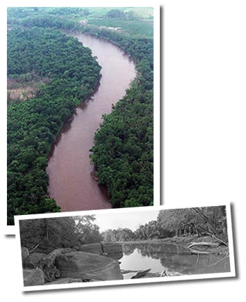
Today, the Minnesota River meanders within a massive valley (topo map). This wide river valley was actually carved by a much larger river. To understand the present landscape, you need to step back in history to the end of the last glacial period (13,000-15,000 years ago) when a continental glacier covered the area. As the glacier melted and retreated, it created the massive freshwater Lake Agassiz—the largest freshwater lake the world has known. This lake covered most of NW Minnesota and far into Canada (map). The lake was 700 miles long and 200 miles wide and covered 110,000 square miles. For comparison, Lake Superior covers 32,700 miles.
River Warren Carves the Valley
About 12,000 years ago, Lake Agassiz broke through a ridge near Big Stone Lake and began draining southeast. The outlet river was the glacial River Warren. At its peak, the River Warren was probably hundreds of feet deep and up to 5 miles wide. For thousands of years, this torrent of water carried away enormous amounts of earth and carved a massive trench across southern Minnesota. The River Warren scoured the river channel deeply eroding through the hundreds of feet of glacial till to bedrock in many areas.
Today, we can easily see the banks of this historic river valley in many places. The valley carved by River Warren lies as much as 250 feet below the surrounding plains. The banks range from 1 to as much as 5 miles across. Today, the Minnesota River flows through this wide valley carved out by the ancient River Warren. The result is a huge valley with a comparatively tiny river flowing within it.
|
|
|