Upper Cannon River Watershed  
Upper Cannon River Watershed Home Upper Cannon MN The Cannon River is located in southern Minnesota.
Cannon River Watershed

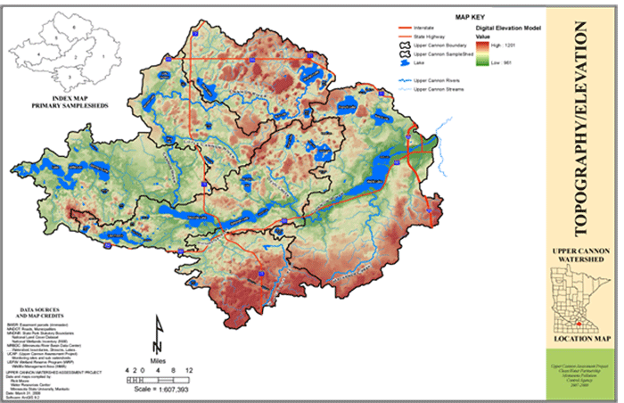
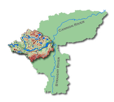
The Cannon River Watershed drains 934,400 acres (1,440 square miles) of land in southern Minnesota. The Cannon originates in Shields Lake in Rice County and joins the Mississippi River 120 miles downstream. The Straight River is a major tributary and many other streams feed the Cannon River.


  Upper Cannon River Watershed The Upper Cannon is a subwatershed of the Cannon River Watershed. It encompasses 212,730 acres (332 square miles). Learn more about the watershed by taking a virtual tour.
     
Upper Cannon Watershed Project Home About the Watershed Interactive Map Water Quality Watershed Tour Projects Maps Links CRWP Home