Upper Cannon River Watershed  
Upper Cannon River Watershed Home   
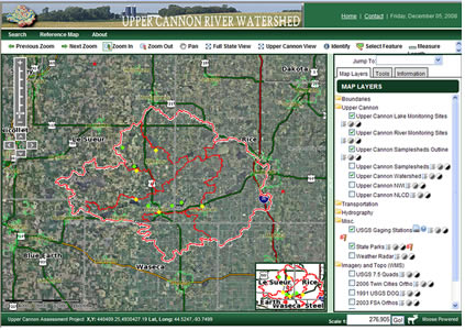
Explore the watershed using an interactive map that includes land use, water quality, wetlands among many other features. Click on the map below to launch the interactive map in a new window. Please note that it may take a few minutes to load.
  Upper Cannon River Watershed Interactive Map
     
Upper Cannon Watershed Project Home About the Watershed Interactive Map Water Quality Watershed Tour Projects Maps Links CRWP Home